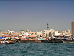
Al Buteen
Appearance
Al Buteen
البطين | |
|---|---|
Community | |
 Al Buteen, located off the Dubai Creek. | |
 | |
| Coordinates: 25°16′07″N 55°17′54″E / 25.26858°N 55.29829°E | |
| Country | United Arab Emirates |
| Emirate | Dubai |
| City | Dubai |
| Area | |
• Total | 0.07 km2 (0.03 sq mi) |
| Population [1] (2000) | |
• Total | 2,364 |
| • Density | 34,000/km2 (87,000/sq mi) |
Al Buteen (Template:Lang-ar) is a locality in Dubai, United Arab Emirates (UAE). Al Buteen is located in eastern Dubai, in Deira and is bounded to its west by Al Ras, its east by Al Sabkha and its north by Al Dhagaya. Dubai Creek forms the southern periphery of the locality.
Al Buteen is located between Old Baladiya Street (110th Road) and 21st Street. Due to its location in the central business district area of Deira, retail space in Al Buteen is expensive.
References
- ^ Existing Population and Future Holding Capacities in Dubai Urban Area Archived 2008-09-11 at the Wayback Machine. Dubai Healthcare City. 2000
