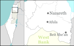
Mle'a
Appearance
Mle'a
| |
|---|---|
| Coordinates: 32°33′47.52″N 35°14′14.27″E / 32.5632000°N 35.2372972°E | |
| Country | Israel |
| District | Northern |
| Council | Gilboa |
| Affiliation | Moshavim Movement |
| Founded | 1956 |
| Founded by | Moroccan Jewish immigrants |
| Population (2022)[1] | 363 |
Mle'a (Template:Lang-he-n) is a moshav in northern Israel. Located in the Ta'anakh region, it falls under the jurisdiction of Gilboa Regional Council. In 2022 it had a population of 363.[1]
History
It was founded in 1956 by Jewish immigrants and refugees to Israel from Morocco in the program to settle the Ta'anakh region. However, by the end of 1957 most of the original settlers moved out, with Jewish immigrants from Poland moving in to replace them. Most residents make a living from agriculture and raising livestock.
The name Mle'a relates to agriculture: in Hebrew, it is a synonym for seed.
References
- ^ a b "Regional Statistics". Israel Central Bureau of Statistics. Retrieved 21 March 2024.

