La Vaca
Appearance
| La Vaca Wetland Humedal La Vaca | |
|---|---|
| Techovita | |
| Location | Kennedy, Bogotá |
| Coordinates | 4°37′38.23″N 74°09′37.12″W / 4.6272861°N 74.1603111°W |
| Area | 7.96 ha (19.7 acres) |
| Elevation | 2,548 m (8,360 ft) |
| Designated | September 2003 |
| Named for | Muysccubun: cacique Techovita |
| Administrator | EAAB - ESP |
| Website | Humedal La Vaca o Techovita |
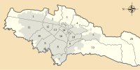
La Vaca (Template:Lang-es) or Techovita is a small wetland, part of the Wetlands of Bogotá, located in the locality Kennedy, Bogotá, Colombia. The wetland, in the Tunjuelo River basin on the Bogotá savanna covers an area of about 8 hectares (20 acres).[1] La Vaca is close to the Avenidad Ciudad de Cali.[2]
Etymology
The alternative name Techovita was the name of a cacique in the Muisca Confederation, the former country on the Altiplano Cundiboyacense before the Spanish conquest.[1]
See also
References
- ^ a b (in Spanish) Humedal La Vaca o Techovita website
- ^ Moreno et al., s.a., p.12
Bibliography
Further reading
External links
- (in Spanish) Fundación Humedales de Bogotá
- (in Spanish) Conozca los 15 humedales de Bogotá - El Tiempo


