Tibabuyes
Appearance
| Tibabuyes Wetland Humedal Tibabuyes | |
|---|---|
| Juan Amarillo Wetland | |
 Tibabuyes Wetland | |
| Location | Suba, Engativá, Bogotá |
| Coordinates | 4°43′49.79″N 74°06′34.9″W / 4.7304972°N 74.109694°W |
| Area | 222.58 ha (550.0 acres) |
| Elevation | 2,539 m (8,330 ft) |
| Designated | September 2003 |
| Named for | Muysccubun: "land of the farmers" |
| Administrator | EAAB - ESP |
| Website | Humedal de Tibabuyes |
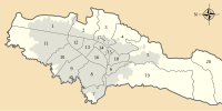
Tibabuyes (Spanish: Humedal de Tibabuyes) or Juan Amarillo Wetland is a wetland, part of the Wetlands of Bogotá, located in the localities Suba and Engativá, Bogotá, Colombia. The wetland, in the Juan Amarillo River basin on the Bogotá savanna is the largest of the wetlands of Bogotá and covers an area of 222 hectares (550 acres).[1]
Etymology
The name Tibabuyes comes from Muysccubun, the language of the indigenous Muisca, who inhabited the Bogotá savanna before the Spanish conquest, and means "land of the farmers".[1]
Flora and fauna
Birds
Tibabuyes hosts 22 bird species.[2]
See also
References
- ^ a b (in Spanish) Website Humedal Tibabuyes
- ^ Andrade & Benitez, s.a., p.8
Bibliography
- Andrade L., Martha Esperanza, and Henry Benitez Castañeda. s.a. Los Humedales de la Sabana de Bogotá: Área Importante para la Conservación de las Aves de Colombia y el Mundo, 1-38. AICAS. Accessed 2017-03-03.
Further reading
- Moreno, Vanesa; Juan Francisco García, and Juan Carlos Villalba. s.a. Descripción general de los humedales de Bogotá D.C., 1-28. Sociedad Geográfica de Colombia. Accessed 2017-03-03.


