Wolf Run State Park
Appearance
| Wolf Run State Park | |
|---|---|
IUCN category V (protected landscape/seascape) | |
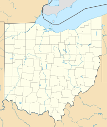
Map of the U.S. state of Ohio showing the location of West Branch State Park | |
| Location | Noble County, Ohio, United States |
| Nearest city | Caldwell |
| Coordinates | 39°47′33″N 81°32′20″W / 39.7925727°N 81.5390129°W[1] |
| Area | Land: 1,046 acres (4.23 km2) Water: 220 acres (0.89 km2) |
| Elevation | 856 [1] |
| Established | 1963 [2] |
| Governing body | Ohio Department of Natural Resources |
Wolf Run State Park is a state park encompassing 1,046 acres (423 ha) in Caldwell, Ohio, United States.[3] The park features swimming, boating and fishing on 220-acre (89 ha) Wolf Run Lake[4] and hiking on trails that include a section of the Buckeye Trail.[5]
References
- ^ a b "Wolf Run State Park". Geographic Names Information System. United States Geological Survey, United States Department of the Interior.
- ^ "Wolf Run State Park: History". Ohio Department of Natural Resources. Retrieved November 19, 2017.
- ^ "Wolf Run State Park". Ohio Department of Natural Resources. Retrieved November 19, 2017.
- ^ "Wolf Run Lake". Ohio Department of Natural Resources Division of Wildlife. Retrieved November 19, 2017.
- ^ "Wolf Run State Park: Activities". Ohio Department of Natural Resources. Retrieved November 19, 2017.
External links
- Wolf Run State Park Ohio Department of Natural Resources
- Wolf Run State Park Map Ohio Department of Natural Resources

