Adarsh Nagar
Appearance
This article needs additional citations for verification. (February 2020) |
Adarsh Nagar | |
|---|---|
Neighbourhood | |
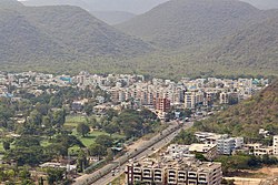
 Adarshnagar from Kailasagiri | |
| Coordinates: 17°45′47″N 83°19′56″E / 17.762925°N 83.332361°E | |
| Country | |
| State | Andhra Pradesh |
| District | Visakhapatnam |
| Government | |
| • Body | Greater Visakhapatnam Municipal Corporation |
| Languages | |
| • Official | Telugu |
| Time zone | UTC+5:30 (IST) |
| PIN | 530040 |
| Vehicle registration | AP-31 |
Adarsh Nagar is a neighborhood in the northern part of Visakhapatnam City, India. It falls under the local administrative limits of Greater Visakhapatnam Municipal Corporation. National Highway 16 passes by this area.[citation needed] Adarsh Nagar is located near to Arilova, Ravindra Nagar and Visalakshi Nagar.
The area is in Madhurawada Zone along with the Indira Gandhi Zoological Park[1] and National Highway 16 and is well-connected with all parts of the city.[citation needed]
References
- ^ "Locals kick up storm over betting centre in Visakhapatam". Times of India. 31 August 2018. Retrieved 15 February 2015.


