Riggend

Coordinates: 55°54′32″N 3°58′41″W / 55.909°N 3.978°W / 55.909; -3.978
From Wikipedia, the free encyclopedia

This is an old revision of this page, as edited by Ser Amantio di Nicolao (talk | contribs) at 02:59, 26 March 2020 (→‎External links: add authority control). The present address (URL) is a permanent link to this revision, which may differ significantly from the current revision.

Riggend from Old Biggar Road

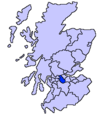
Riggend is a hamlet in North Lanarkshire, Scotland.[1] It is on the A73 Stirling Road not far from Wattston.

References

  1. ^ "O.S. Map with zoom and Bing overlay". National Library of Scotland. Ordnance Survey. Retrieved 30 December 2017.

External links

55°54′32″N 3°58′41″W / 55.909°N 3.978°W / 55.909; -3.978