Twynholm
| Twynholm | |
|---|---|
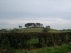
 A hill fort west of Twynholm | |
Location within Dumfries and Galloway | |
| Population | 119 (2001 Census) |
| OS grid reference | NX6654 |
| Council area | |
| Lieutenancy area | |
| Country | Scotland |
| Sovereign state | United Kingdom |
| Post town | Kirkcudbright |
| Postcode district | DG6 |
| Dialling code | 01557 |
| Police | Scotland |
| Fire | Scottish |
| Ambulance | Scottish |
| UK Parliament | |
| Scottish Parliament | |
Twynholm (/ˈtwaɪnəm/ 'TWINE-um') is a village in Scotland. It is located 2+1⁄4 miles (3.6 km) north-northwest of Kirkcudbright and 4+1⁄2 miles (7.2 km) east of Gatehouse of Fleet on the main A75 trunk road.[1] It is in the historic county of Kirkcudbrightshire ,[2] Dumfries and Galloway.[3]
The etymology of the name is uncertain. It may be from the British twyn (a bank or hillock) and the Saxon hame meaning home,[4] or be of Scots derivation and mean "between the river banks".[5]
History
The village was founded in the 16th century when two mills were set up on the burn which passes through the village centre. In the 18th century, the first school was built in the village, with the current primary school built in 1911.[3] Twynholm was a parish from medieval times until 1975, including the neighbouring parish of Kirkchrist from 1654.[6]
In 1887, John Bartholomew's Gazetteer of the British Isles described Twynholm like this:
Twynholm, par. and vil., Kirkcudbrightshire - par., 10,484 ac., pop. 681; vil., 3 miles NW. of Kirkcudbright; P.O.
— John Bartholomew, Gazetteer of the British Isles (1887)[7]
There are a variety of listed buildings in the vicinity including the ruins of the 16th century Cumstoun Castle,[8] and the parish church.[9] The church was constructed in 1818 and was restored and the roof replaced in 1914. In 1963, a church porch was added.[3]
Notable residents
- Finlay Carson (born 1967), Member of the Scottish Parliament (MSP) for the Galloway and West Dumfries constituency since the 2016 Scottish Parliament election, born, raised and lives in Twynholm[10]
- David Coulthard (born 1971), former Formula One racing driver, is from Twynholm.[11][12]
See also
References
- ^ Ordnance Survey. OS Maps Online (Map). 1:25,000. Leisure.
- ^ "Twynholm". Gazetteer for Scotland. Retrieved 2 January 2014.
- ^ a b c "Twynholm". Undiscovered Scotland. Retrieved 13 August 2019.
- ^ Gordon, Rev. John "The Parish of Twynholm" in The New Statistical Account of Scotland: Dumfries, Kirkcudbright, Wigton (1845) W. Blackwood and Sons. Page 37. Retrieved 3 January 2014.
- ^ Blackie, Christina (1876) Etymological Geography Daldy, Isbister, & Company. Page 89. Retrieved 3 January 2014.
- ^ "Search results for twynholm". Scotland's Places. Retrieved 2 January 2014.
- ^ Map and description, A Vision of Britain through Time GB Historical GIS / University of Portsmouth, History of Twynholm, in Dumfries and Galloway and Kirkcudbrightshire. Date accessed: 13 August 2019
- ^ Historic Environment Scotland. "Cumstoun Castle (SM8263)". Retrieved 26 March 2019.
- ^ Historic Environment Scotland. "Twynholm Parish Church, (Church of Scotland), and Graveyard (Category B Listed Building) (LB16986)". Retrieved 26 March 2019.
- ^ "Finlay Carson launches Holyrood campaign". 29 March 2016. Retrieved 7 May 2016.
- ^ "Draught guidance: a kilt need underwear". Daily Telegraph. Retrieved 2 January 2014.
- ^ "Drivers: David Coulthard". GrandPrix.com. Retrieved 13 December 2011.
External links

