Dalfsen
Appearance
Dalfsen | |
|---|---|
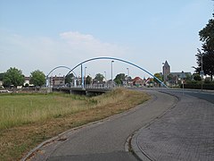
 Dalfsen town centre | |
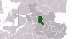
 Location in Overijssel | |
| Coordinates: 52°30′N 6°15′E / 52.500°N 6.250°E | |
| Country | Netherlands |
| Province | Overijssel |
| Government | |
| • Body | Municipal council |
| • Mayor | Erica van Lente (PvdA) |
| Area | |
| • Total | 166.52 km2 (64.29 sq mi) |
| • Land | 165.07 km2 (63.73 sq mi) |
| • Water | 1.45 km2 (0.56 sq mi) |
| Elevation | 3 m (10 ft) |
| Population (January 2021)[3] | |
| • Total | 28,901 |
| • Density | 175/km2 (450/sq mi) |
| Demonym(s) | Dalfsenaar, Dalfser |
| Time zone | UTC+1 (CET) |
| • Summer (DST) | UTC+2 (CEST) |
| Postcode | 7710–7714, 7720–7729, 8150–8159 |
| Area code | 0529, 0572 |
| Website | www |
Dalfsen (, Dutch Low Saxon: Dalsen) is a municipality and a town in the Salland region of the Dutch province of Overijssel. The municipality of Dalfsen was increased to its current size on 1 January 2001 through the amalgamation of the municipalities of Nieuwleusen and Dalfsen.
History
The name first appears in documents in 1231. Due to the closeness of Kasteel Rechteren, Dalfsen is one of several towns along the Overijssel section of the Vecht river never to have received city rights.[citation needed]
Population centres
- Ankum
- Dalfsen
- Dalfserveld
- Dalmsholte
- De Marshoek
- De Meele
- Emmen
- Gerner
- Hessum
- Hoonhorst
- Lemelerveld
- Lenthe
- Leusenerveld
- Nieuwleusen
- Oudleusen
- Oudleusenerveld
- Rechteren
- Strenkhaar
- Welsum
Topography
Dutch Topographic map of the municipality of Dalfsen, June 2015.
Transportation
Notable people

- Willem Lodewijk de Vos van Steenwijk (1859 in Dalfsen – 1947) a conservative Dutch politician
- Peter Nijkamp (born 1946 in Dalfsen) a Dutch economist and academic
- Ilse Warringa (born 1975 in Dalfsen) a Dutch Voice actress and actress [4]
Sport
- René Eijkelkamp (born 1964 in Dalfsen) a Dutch former footballer with 469 club caps and current coach
- Erben Wennemars (born 1975 in Dalfsen) a Dutch former speed skater
- Manon Nummerdor-Flier (born 1984 in Nieuwleusen) a retired volleyball player
- Korie Homan (born 1986 in de Wijk) a Dutch former wheelchair tennis player, gold medallist at the 2008 Paralympics
- Maikel Kieftenbeld (born 1990 in Lemelerveld) a Dutch professional footballer with over 300 club caps
Photos
-
Aalshorst Dalfsen
-
Dalfsen, windmill: de Westermolen
-
Dalfsen, view to the town
-
Hoonhorst, windmill:molen de Fakkert
References
- ^ "Kerncijfers wijken en buurten 2020" [Key figures for neighbourhoods 2020]. StatLine (in Dutch). CBS. 24 July 2020. Retrieved 19 September 2020.
- ^ "Postcodetool for 7721AX". Actueel Hoogtebestand Nederland (in Dutch). Het Waterschapshuis. Retrieved 27 March 2014.
- ^ "Bevolkingsontwikkeling; regio per maand" [Population growth; regions per month]. CBS Statline (in Dutch). CBS. 1 January 2021. Retrieved 2 January 2022.
- ^ IMDb Database retrieved 20 August 2019
External links
 Media related to Dalfsen at Wikimedia Commons
- Official website


