Waitangi, Chatham Islands
Waitangi | |
|---|---|
 Town of Waitangi on Chatham Island in May 2008. | |
| Coordinates: 43°57′05″S 176°33′40″W / 43.95139°S 176.56111°W | |
| Country | |
| Territorial authority | Chatham Islands |
| Time zone | Chatham Standard Time Zone |
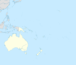
Waitangi is the main port and settlement on the Chatham Islands. It is located on the southern shore of Petre Bay, on the west coast of the main island. This community is by far the largest settlement in the archipelago, with a population of about 250, about 40% of the group's population, estimated in 2016 to be 610. The population has been decreasing but has stabilized over the last four years.[1]
Waitangi is the seat of Chatham Islands Council, hosts a visiting District Court Judge, and is the base of a local police constable. A doctor and two nurses staff a four-bedroom hospital facility. Te One School and Kaingaroa School are based near the settlement.
Local services in Waitangi include Port Waitangi and Fish Processing Factory, an ANZ Bank and Post Office, liquor store, general store, burger cafe, and a hotel and pub. Local volunteers run radio station Radio Weka and rebroadcast New Zealand television. Telephone is available via satellite to New Zealand, but there is no mobile reception.
The town includes two tribal meeting grounds. Kopinga is the meeting ground of Moriori, and includes the Hokomenetai meeting house. Whakamaharatanga is the marae (meeting grounds) of Ngāti Mutunga, and includes the Whakamaharatanga wharenui (meeting house).[2][3]
Climate
Waitangi experiences an oceanic climate with mild winters and warm summers. Precipitation can fall at any time throughout the year, with the highest percent of rain being centered during the winter.
| Climate data for Waitangi, Chatham Islands | |||||||||||||
|---|---|---|---|---|---|---|---|---|---|---|---|---|---|
| Month | Jan | Feb | Mar | Apr | May | Jun | Jul | Aug | Sep | Oct | Nov | Dec | Year |
| Mean daily maximum °C (°F) | 17.8 (64.0) |
18.1 (64.6) |
17.3 (63.1) |
15.4 (59.7) |
13.4 (56.1) |
11.5 (52.7) |
10.9 (51.6) |
11.4 (52.5) |
12.3 (54.1) |
13.2 (55.8) |
14.6 (58.3) |
16.5 (61.7) |
14.4 (57.9) |
| Daily mean °C (°F) | 14.8 (58.6) |
15.1 (59.2) |
14.4 (57.9) |
12.5 (54.5) |
10.5 (50.9) |
8.8 (47.8) |
8.0 (46.4) |
8.6 (47.5) |
9.5 (49.1) |
10.6 (51.1) |
11.9 (53.4) |
13.7 (56.7) |
11.5 (52.8) |
| Mean daily minimum °C (°F) | 11.9 (53.4) |
12.2 (54.0) |
11.5 (52.7) |
9.7 (49.5) |
7.6 (45.7) |
6.2 (43.2) |
5.2 (41.4) |
5.8 (42.4) |
6.7 (44.1) |
8.0 (46.4) |
9.3 (48.7) |
11.0 (51.8) |
8.8 (47.8) |
| Average precipitation mm (inches) | 52 (2.0) |
56 (2.2) |
85 (3.3) |
74 (2.9) |
90 (3.5) |
93 (3.7) |
109 (4.3) |
79 (3.1) |
68 (2.7) |
56 (2.2) |
53 (2.1) |
71 (2.8) |
886 (34.9) |
| Source: http://en.climate-data.org/location/475472/ | |||||||||||||
References
- ^ This data was generated via the Infoshare resource, looking at the table for Estimated Resident Population for Territorial Authority Areas, but the URL is dynamic. Go to the Infoshare section of the Stats NZ website http://www.stats.govt.nz/infoshare/ to recreate.
- ^ "Te Kāhui Māngai directory". tkm.govt.nz. Te Puni Kōkiri.
- ^ "Māori Maps". maorimaps.com. Te Potiki National Trust.
External links
- chathams.co.nz
- Chatham Islands (last updated 1998)
- Photographs of Waitangi 1907, c1920


