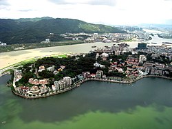
Penha Hill
Appearance
22°11′11.3″N 113°32′5.0″E / 22.186472°N 113.534722°E
| Penha Hill | |
|---|---|
| Colina da Penha | |
 | |
| Highest point | |
| Elevation | 62.7 m (206 ft) |
| Naming | |
| Native name | 西望洋山 Error {{native name checker}}: parameter value is malformed (help) |
| Geography | |
| Location | São Lourenço, Macau, China |
| Geology | |
| Mountain type | Hill |
| Penha Hill | |||||||||||
|---|---|---|---|---|---|---|---|---|---|---|---|
| Chinese | 西望洋山 | ||||||||||
| |||||||||||
The Penha Hill (Chinese: 西望洋山; Portuguese: Colina da Penha) is a hill in São Lourenço, Macau, China.[1]
Geology
At an elevation of 62.7 meters above sea level, the hill is the third highest hill in Macau.
Features
At the top of the hill stands the Our Lady of Penha Chapel. There are also markets, hotels and restaurants around the hill.[2]
See also
References
- ^ "Penha Hill". VisitOurChina. Retrieved 16 January 2017.
- ^ "Penha Hill in Macau". Cultural China. Retrieved 16 January 2017.[permanent dead link]
Wikimedia Commons has media related to Penha Hill.
