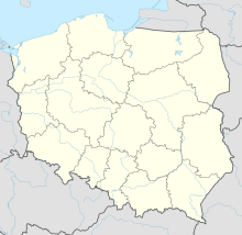
Gdynia-Kosakowo Airport
Appearance
Gdynia-Kosakowo Airport Port Lotniczy Gdynia-Kosakowo | |||||||||||
|---|---|---|---|---|---|---|---|---|---|---|---|
 | |||||||||||
| Summary | |||||||||||
| Airport type | Public | ||||||||||
| Serves | Gdynia, Poland | ||||||||||
| Elevation AMSL | 148 ft / 45 m | ||||||||||
| Coordinates | 54°34′47″N 18°31′02″E / 54.57972°N 18.51722°E | ||||||||||
| Website | www.airport.gdynia.pl/ | ||||||||||
| Map | |||||||||||
 | |||||||||||
| Runways | |||||||||||
| |||||||||||
| Statistics (2007 +/- change from 2006) | |||||||||||
| |||||||||||
Airport Gdynia-Kosakowo (also known as Gdynia-Oksywie, Gdynia-Babie Doły) is a civil (under construction) and military airport in northern Poland.
The governing authority of the city of Gdynia is building this airport as a secondary choice to the main airport at Rebiechowo, near Gdansk, which allows another economic boost to the area.
History
The airport opened before 1939. 1 May 1935 was the official opening date for the Gdynia- Rumia Zagórze passenger airport. There were daily flights to Warsaw, Cracow, Copenhagen, Venice, Rome, Milano, Budapest.
Airport infrastructure
There exists a railroad line next to the terminal that can be used for passenger service. Pomorska Kolej Metropolitalna company was created to introduce the rail link.
References
External links
Wikimedia Commons has media related to Gdynia-Kosakowo Airport.

