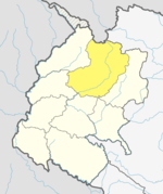
Thalara
Appearance
This article's factual accuracy may be compromised due to out-of-date information. (August 2018) |
Thalara
थलारा | |
|---|---|
| Coordinates: 29°29′N 80°59′E / 29.483°N 80.983°E | |
| Country | |
| Province | Sudurpashchim Pradesh |
| District | Bajhang District |
| Time zone | UTC+5:45 (Nepal Time) |
Thalara is a former village development committee that is now a Rural Municipality in Bajhang District in Sudurpashchim Pradesh of western Nepal. It lies on the Seti River. Thalara is made with its former VDCs, Dangaji, Parakatne, Kot Bhairab, Koiralakot and Malumela.
References


