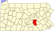
Hanoverdale, Pennsylvania
Appearance
Hanoverdale is an unincorporated community in Dauphin County, Pennsylvania in the Harrisburg-Carlisle Metropolitan Statistical Area, the latitude is 40.321, and the longitude -76.704, its elevation is 515 feet (157 m). Hanoverdale is located at the intersection of Hershey Road and Devonshire Heights Road.
40°19′16″N 76°42′14″W / 40.321°N 76.704°W
External links

