Mahakam Ulu Regency
Mahakam Ulu Regency
Kabupaten Mahakam Ulu | |
|---|---|
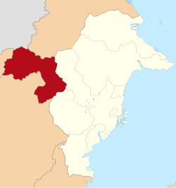
 Location within East Kalimantan | |
Location in Kalimantan and Indonesia | |
| Coordinates: 0°30′N 115°17′E / 0.5°N 115.28°E | |
| Country | Indonesia |
| Region | Kalimantan |
| Province | East Kalimantan |
| Capital | Ujoh Bilang |
| Government | |
| • Regent | Bonifasius Belawan Geh |
| • Vice Regent | Y. Juan Jenau |
| Area | |
| • Total | 7,100.3 sq mi (18,389.6 km2) |
| Population (2010 Census) | |
| • Total | 24,994 |
| • Density | 3.5/sq mi (1.4/km2) |
| Time zone | UTC+8 (ICST) |
| Area code | (+62) 545 |
| Website | mahakamulukab |
Mahakam Ulu Regency is a regency (kabupaten) in the province of East Kalimantan, Indonesia. It covers an area of 18,389.6 km2, and at the 2010 Census it had a population of 24,994 (within the new regency). The regency was established on 14 December 2012, partitioned from West Kutai Regency.[1]
Administration
The regency is divided into five districts (kecamatan), tabulated below with their 2010 areas and Census populations[2].
| Name | Area in km2 |
Population Census 2010[3] |
|---|---|---|
| Long Hubung | 2,426.1 | 6,405 |
| Laham | 2,327.4 | 2,275 |
| Long Bagun | 4,674.6 | 7,886 |
| Long Pahangai | 4,043.0 | 4,326 |
| Long Apari | 4,918.5 | 4,102 |
References
- ^ DPR Sahkan 7 Kabupaten Baru. www.kompas.com. Sabtu, 15 December 2012. Accessed 30 December 2012
- ^ Biro Pusat Statistik, Jakarta, 2011.
- ^ 2010 Indonesian Census


