Namua
Appearance
 | |
 | |
| Geography | |
|---|---|
| Location | South Pacific Ocean |
| Coordinates | 14°01′S 171°25′W / 14.017°S 171.417°W |
| Area | 95,326 m2 (1,026,080 sq ft) |
| Coastline | 1.66 km (1.031 mi) |
| Administration | |
| District | Atua |
| Demographics | |
| Population | 0 |
| Additional information | |
| Time zone | |
| • Summer (DST) |
|
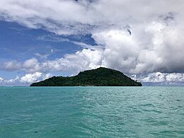
Namu'a is a small uninhabited island off the east coast of Upolu island in Samoa.
The island is a 10-minute boat ride from Upolu and has beach fale accommodation for visitors.[1] There are lookouts and it takes about an hour to walk around the island.
Namua is one of four small islands in the Aleipata Islands.
See also
References
- ^ "Archived copy". Archived from the original on 2011-09-27. Retrieved 2009-10-25.
{{cite web}}: CS1 maint: archived copy as title (link)

