Eleme, Rivers
Appearance
This article possibly contains original research. (May 2020) |
Eleme | |
|---|---|
| Country | Nigeria |
| State | Rivers State |
| Date created | 1996 |
| Seat | Ogale |
| Government | |
| • Type | Local Government |
| • Local Government chairman | Hon Barr Philip Okparaji |
| Area | |
| • Total | 53 sq mi (138 km2) |
| Population (2006) | |
| • Total | 190,884 |
| Time zone | UTC+1 (WAT) |
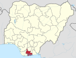
Eleme is a local government area in Rivers State, Nigeria. It is part of the Port Harcourt metropolitan city. It covers an area of 138 km2 and at the 2006 Census had a population of 190,884. The Eleme people are Eleme's main indigenous ethnic group.
The Eleme language, of the Ogonoid group of the Cross-River branch of the large Niger-Congo language family,[1] is the main spoken language.[2]
Eleme has two of Nigeria's four, as of 2005, petroleum refineries and one of Nigeria's busiest sea ports and the largest sea port in West Africa located at Onne, a famous town with numerous industries.[3]
Notes
- ^ Anderson, Gregory D. S. (2006) "Appendix: Classification of Languages Used in Database for Study" Auxiliary verb constructions Oxford University Press, Oxford, England, page 400, ISBN 0-19-928031-2
- ^ Udoh, Imelda Icheji Lawrence (editor) (2003) The languages of the South-South zone of Nigeria: a geo-political profile Concept Publications, Lagos, Nigeria, pages 85, 87, ISBN 978-8065-27-9
- ^ Udogu, Emmanuel Ike (2005) Nigeria in the twenty-first century: strategies for political stability and peaceful coexistence Africa World Press, Trenton, New Jersey, page 72, ISBN 1-59221-319-7

