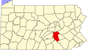
Montrose Park, Pennsylvania
Appearance
Montrose Park is a populated place and unincorporated community in Dauphin County, Pennsylvania in the Harrisburg-Carlisle Metropolitan Statistical Area, the latitude is 40.302, and the longitude -76.900, its elevation is 331 feet (101 m). It is roughly bounded by Front Street to the west; Montrose Street to the north, Sixth Street to the east and the Harrisburg city line to the south.
40°18′07″N 76°54′00″W / 40.302°N 76.900°W
External links

