Indios Verdes metro station
| STC rapid transit | |||||||||||
 Platforms of the station | |||||||||||
| General information | |||||||||||
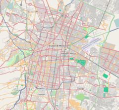
| Location | Avenida de los Insurgentes Norte Gustavo A. Madero Mexico City Mexico | ||||||||||
| Coordinates | 19°29′43″N 99°07′10″W / 19.495358°N 99.119468°W | ||||||||||
| Platforms | 2 island platforms | ||||||||||
| Tracks | 3 | ||||||||||
| Connections | Mexibús Indios Verdes | ||||||||||
| Construction | |||||||||||
| Structure type | Surface | ||||||||||
| Platform levels | 1 | ||||||||||
| Parking | No | ||||||||||
| Bicycle facilities | No | ||||||||||
| Accessible | Yes | ||||||||||
| History | |||||||||||
| Opened | 1 December 1979 | ||||||||||
| Passengers | |||||||||||
| 2018 | 40,302,169[1] | ||||||||||
| Rank | 2/195[1] | ||||||||||
| Services | |||||||||||
| |||||||||||
| |||||||||||
Indios Verdes is a station on the Mexico City Metro. Indios Verdes, located in the northern reaches of Mexico City, is the current terminal station for the Metro's Line 3. In 2019, the station had an average ridership of 118,633 passengers per day, making it the second busiest station in the entire network after Pantitlán.[2]
General information
Indios Verdes literally means "Green Indians". The station and its surrounding area have this name because of nearby monuments to two Aztec emperors, Itzcoatl and Ahuizotl. The two statues – originally planned to be sited in a more central location on Paseo de la Reforma – were made of cast bronze, and the metal has turned green with the passage of time and the effects of the weather. Because of this, people began to call the monuments los indios verdes. The Metro Indios Verdes station logo depicts the statues' silhouettes.
The station has two island platforms, one for arriving and one for departing trains.
Metro Indios Verdes station plays an important role in transportation for both Mexico City and areas of the surrounding state of México. The station has many entrances and exits, and it connects with many bus and microbuses routes, most of them serving areas in the Estado de México such as Lechería, Tlalnepantla de Baz, Texcoco, towns like Tepexpan and Otumba, and the archaeological zone of Teotihuacán. This station is located near the Mexico City to Nuevo Laredo highway.
The "Metrobús" bus rapid transit line was constructed near the metro terminal in 2005; it runs from Metro Indios Verdes all the way down Avenida Insurgentes to Monumento al Caminero in the south of Mexico City.
Metro Indios Verdes is the busiest station on the Mexico City metro, with 46.7 million passenger boardings in 2012.[3]
Exits
- Northwest: Avenida de los Insurgentes Norte, Acueducto de Guadalupe
- Northeast: Avenida de los Insurgentes Norte, Santa Isabel Tola
References
- ^ a b "Afluencia de estación por línea 2018" (in Spanish). Sistema Transporte Colectivo Metro. 2019. Archived from the original on 6 June 2019. Retrieved 7 April 2020.
- ^ "Estaciones de mayor afluencia 2019" (in Spanish). Metro CDMX. Retrieved 29 March 2020.
- ^ "Archived copy". Archived from the original on 2013-10-14. Retrieved 2014-12-08.
{{cite web}}: CS1 maint: archived copy as title (link)
![]() Media related to Indios Verdes (station) at Wikimedia Commons
Media related to Indios Verdes (station) at Wikimedia Commons

