Gavà
Appearance
Gavà | |
|---|---|
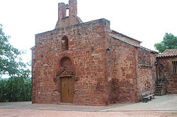
 Ermita de Bruguers | |
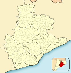
| Coordinates: 41°18′26″N 2°00′14″E / 41.30722°N 2.00389°E | |
| Country | |
| Community | |
| Province | Barcelona |
| Comarca | Baix Llobregat |
| Government | |
| • Mayor | Raquel Sánchez Jiménez (2015)[1] |
| Area | |
| • Total | 30.8 km2 (11.9 sq mi) |
| Elevation | 9 m (30 ft) |
| Population (2018)[3] | |
| • Total | 46,705 |
| • Density | 1,500/km2 (3,900/sq mi) |
| Website | www |

Gavà (Catalan pronunciation: [ɡəˈβa]) is a municipality in the Baix Llobregat comarca, in the province of Barcelona in Catalonia, Spain. It borders the coast of the Mediterranean Sea between Viladecans and Castelldefels.
Gavà has a beach and two population centers:
- Gavà: the city proper
- Gavà Mar (Gavà Sea): a neighborhood by the beachside
Gavà's mayor belongs to the Socialists' Party of Catalonia.[citation needed]
Education
This section needs expansion. You can help by adding to it. (February 2016) |
Lycée Français de Gavà Bon Soleil, a French international school, is in the town.
Demography
| 1900 | 1930 | 1950 | 1970 | 1986 | 2007 |
|---|---|---|---|---|---|
| 1825 | 5054 | 6860 | 24,213 | 32,351 | 44,678 |
References
- ^ "Ajuntament de Gavà". Generalitat of Catalonia. Retrieved 2015-11-13.
- ^ "El municipi en xifres: Gavà". Statistical Institute of Catalonia. Retrieved 2015-11-23.
- ^ Municipal Register of Spain 2018. National Statistics Institute.
- Panareda Clopés, Josep Maria; Rios Calvet, Jaume; Rabella Vives, Josep Maria (1989). Guia de Catalunya, Barcelona: Caixa de Catalunya. ISBN 84-87135-01-3 (Spanish). ISBN 84-87135-02-1 (Catalan).
External links
- The Website of Gavà (in Catalan | Spanish | English)
- Artistic and historical buildings in Gavà (in Catalan)
- The Website of Gavà Mar (in Catalan | Spanish | English | French)
- Government data pages (in Catalan)


