River Oaks station
Appearance
| VTA light rail station | ||||||||||||||||
 River Oaks Station, 2012 | ||||||||||||||||
| General information | ||||||||||||||||
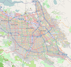
| Location | 1st Street and River Oaks Parkway San Jose, California | |||||||||||||||
| Coordinates | 37°24′08″N 121°56′23″W / 37.402170°N 121.939649°W | |||||||||||||||
| Owned by | VTA | |||||||||||||||
| Platforms | 2 far-side platforms | |||||||||||||||
| Connections | ||||||||||||||||
| Construction | ||||||||||||||||
| Parking | 22 spaces | |||||||||||||||
| Accessible | Yes | |||||||||||||||
| History | ||||||||||||||||
| Opened | December 11, 1987[1] | |||||||||||||||
| Services | ||||||||||||||||
| ||||||||||||||||
| ||||||||||||||||
River Oaks is a light rail station operated by Santa Clara Valley Transportation Authority. This station is served by the Blue and Green lines of the VTA Light Rail system.
Location
The station is located in San Jose, California in the center median of 1st Street at River Oaks Parkway. The stop serves its immediate San Jose neighborhood, which includes VTA's administration office, as well as a nearby portion of Santa Clara opposite the Guadalupe River, accessible via a bicycle-pedestrian bridge.[2] The bridge makes River Oaks one of VTA's few North San Jose light rail stops to serve a residential neighborhood, as North San Jose is almost entirely industrial.
Station layout
| Platform | Side platform, doors will open on the right | |
| Northbound | ← ← | |
| Southbound | → → | |
| Side platform, doors will open on the right | ||
Connecting transit
- ACE Shuttle: Brown
References
- ^ "VTA Facts: Light Rail System" (PDF). Santa Clara Valley Transportation Authority. November 30, 2006. Archived from the original (PDF) on March 20, 2009. Retrieved January 10, 2020.
- ^ "River Oaks Bicycle/Pedestrian Bridge Project". Retrieved 4 June 2011.
External links
 Media related to River Oaks (VTA) at Wikimedia Commons
- Transit Unlimited
Categories:
- Santa Clara Valley Transportation Authority light rail stations
- Santa Clara Valley Transportation Authority bus stations
- Railway stations in San Jose, California
- Railway stations in the United States opened in 1987
- 1987 establishments in California
- Tram stubs
- Santa Clara County, California railway station stubs
- San Jose, California building and structure stubs


