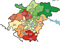
Tepa, Ghana
Tepa
Tepaman | |
|---|---|
Location of Tepa within Ashanti | |
| Coordinates: 7°0′N 2°10′W / 7.000°N 2.167°W | |
| Sovereign state | |
| Region | |
| District | Ahafo Ano North District |
| Government | |
| • Omanhene | Nana Adusei Atwenewa Ampem |
| Elevation | 797 ft (243 m) |
Tepa is a small town and is the capital of Ahafo Ano North, a district in the Ashanti Region of Ghana.[1] The old town of Tepa is known as Kelebim. Kelebim can be found in Tepa Ward 1 (Banieh Krom). The major occupation of the people there is Farming.
References
External links
- Recent weather in Tepa
- www.wanzitech.com
7°00′N 2°10′W / 7.000°N 2.167°W


