Maam Cross
This article needs additional citations for verification. (June 2020) |
Maam Cross
an Teach Dóite | |
|---|---|
Townland | |
| Coordinates: 53°27′00″N 9°32′00″W / 53.45°N 9.5333°W | |
| Country | Ireland |
| Province | Connacht |
| County | County Galway |
| Elevation | 150 m (490 ft) |
| Time zone | UTC+0 (WET) |
| • Summer (DST) | UTC-1 (IST (WEST)) |
| Irish Grid Reference | L981455 |
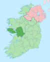
Maam Cross (Irish: an Teach Dóite, meaning 'the burned house') is a crossroads in Connemara, County Galway, Ireland. It lies within the townland of Shindilla, at the junction of the R59 from Galway to Clifden and the R336 from Galway to the Maam Valley which runs from Maum or Maam to Leenaun or Leenane.
Transport
Maam Cross railway station, on the Galway - Clifden line, opened on 1 January 1896 and finally closed on 29 April 1935.[1]
See also
References
- ^ "Maam Cross station" (PDF). Railscot - Irish Railways. Retrieved 3 November 2007.


