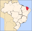
Alcântaras
Alcântaras | |
|---|---|
Municipality | |
 | |
| Coordinates: 03°35′20″S 40°32′45″W / 3.58889°S 40.54583°W | |
| Country | |
| Region | Nordeste |
| State | Ceará |
| Mesoregion | Noroeste Cearense |
| Time zone | UTC -3 |
Alcântaras is a municipality in the state of Ceará in the Northeast region of Brazil.[1][2][3][4]
Culture
Quadrilha Junina (Festival de Quadrilhas Juninas de Alcântaras): Hundreds of large groups of traditional folke dances that organize to make presentations, usually to the sound of Forró, during the festas juninas, in the month of June (and also July).
Cuisine: Brazilian cuisine includes feijoada. There are some dishes which are typical of the northeast of Brazil, as macaxera, tapioca, carne do sol, but the typical food of Ceará is Baião de Dois.[5]
Religion: The dominant Religion of Alcântaras is Roman Catholicism due to the influence Portuguese.[5]
Climate
Alcântaras has a typical tropical climate. The climate of Alcântaras is hot almost all year. The temperature in the municipality varies from 18 to 36 °C (64 to 97 °F)[6]
Government
- Eliesio Fonteles
- Joaquim Carvalho[6]
Notable people
Caetano Ximenes de Aragão, doctor and writer (February 24, 1927 - June 14, 1995).[6]
Access
One road give access to the city: CE-241.
Schools
There are five schools on the city.
- Escola Gregório Cunha Freire
- Escola José P. Barroso
- Escola Inocência Alcântara Freire
- Escola Estadual Francisco de Almeida Monte
- Escola Maria Raulino[6]
Media
The city has one radio station, Rádio Bela Vista FM.[6][7]
References
- ^ "Divisão Territorial do Brasil" (in Portuguese). Divisão Territorial do Brasil e Limites Territoriais, Instituto Brasileiro de Geografia e Estatística (IBGE). July 1, 2008. Retrieved December 17, 2009.
- ^ "Estimativas da população para 1º de julho de 2009" (PDF) (in Portuguese). Estimativas de População, Instituto Brasileiro de Geografia e Estatística (IBGE). August 14, 2009. Retrieved December 17, 2009.
- ^ "Ranking decrescente do IDH-M dos municípios do Brasil" (in Portuguese). Atlas do Desenvolvimento Humano, Programa das Nações Unidas para o Desenvolvimento (PNUD). 2000. Archived from the original on October 3, 2009. Retrieved December 17, 2009.
- ^ "Produto Interno Bruto dos Municípios 2002-2005" (PDF) (in Portuguese). Instituto Brasileiro de Geografia e Estatística (IBGE). December 19, 2007. Archived from the original (PDF) on October 2, 2008. Retrieved December 17, 2009.
- ^ a b http://portaljovensac.blogspot.com/
- ^ a b c d e http://portaljovensac.blogspot.com
- ^ "Archived copy". Archived from the original on 2014-05-16. Retrieved 2014-06-12.
{{cite web}}: CS1 maint: archived copy as title (link)


