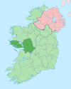
Lawrencetown, County Galway
Appearance
This article needs additional citations for verification. (June 2020) |
Lawrencetown
Baile Mór Shíol Anmchadha | |
|---|---|
Village | |
| Coordinates: 53°13′49″N 8°10′48″W / 53.2303°N 8.18°W | |
| Country | Ireland |
| Province | Connacht |
| County | County Galway |
| Elevation | 83 m (272 ft) |
| Time zone | UTC+0 (WET) |
| • Summer (DST) | UTC-1 (IST (WEST)) |
| Irish Grid Reference | M880199 |
Lawrencetown or Laurencetown (Irish: Baile Mór Shíol Anmchadha or simply Baile Mór), historically called Ballymore,[1] is a village in County Galway, Ireland. It lies on the R355 regional road nine miles south of Ballinasloe . It is named after the 'Lawrence' family. Facilities in Lawrencetown include the community hall, St. Mary's church, the national school, two pubs and a shop.
References
- ^ Placenames Database of Ireland (see archival records)


