Mitrit
Appearance
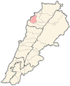
Mitrit (Template:Lang-ar) is a mixed Shia Muslim and Maronite village in the Koura District, Lebanon.[1][2]
References
- ^ "Municipal and ikhtiyariah elections in Northern Lebanon" (PDF). The Monthly. March 2010. p. 23. Archived from the original on 3 June 2016. Retrieved 31 October 2016.
{{cite web}}: CS1 maint: bot: original URL status unknown (link) - ^ "أقلية شيعية في شمال لبنان تهدد بتعطيل الانتخابات بسبب إقصائها, أخبــــــار". archive.aawsat.com.
External links
- Metrit, Localiban
34°16′N 35°51′E / 34.267°N 35.850°E

