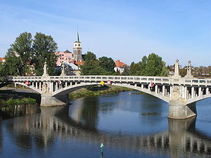
Nymburk District
Nymburk District
Okres Nymburk | |
|---|---|
 Nymburk town | |
 District location in the Central Bohemian Region within the Czech Republic | |
| Country | |
| Region | Central Bohemian |
| Capital | Nymburk |
| Area | |
| • Total | 850.07 km2 (328.21 sq mi) |
| Population (2019-01-01[1]) | |
| • Total | 99,873 |
| • Density | 120/km2 (300/sq mi) |
| Time zone | UTC+1 (CET) |
| • Summer (DST) | UTC+2 (CEST) |
| Municipalities | 87 |
| * Towns | 7 |
| * Market towns | 3 |
| * Villages | 77 |
Nymburk District (Czech: okres Nymburk) is a district (okres) within Central Bohemian Region of the Czech Republic. Its capital is the town of Nymburk.
Complete list of municipalities
Běrunice - Bobnice - Bříství - Budiměřice - Černíky - Chleby - Choťánky - Chotěšice - Chrást - Chroustov - Čilec - Činěves - Dlouhopolsko - Dobšice - Dvory - Dymokury - Hořany - Hořátev - Hradčany - Hradištko - Hrubý Jeseník - Jíkev - Jiřice - Jizbice - Kamenné Zboží - Kněžice - Kněžičky - Kolaje - Kostelní Lhota - Kostomlátky - Kostomlaty nad Labem - Košík - Kounice - Kouty - Kovanice - Krchleby - Křečkov - Křinec - Libice nad Cidlinou - Loučeň - Lysá nad Labem - Mcely - Městec Králové - Milčice - Milovice - Netřebice - Nový Dvůr - Nymburk - Odřepsy - Okřínek - Opočnice - Opolany - Oseček - Oskořínek - Ostrá - Pátek - Písková Lhota - Písty - Poděbrady - Podmoky - Přerov nad Labem - Rožďalovice - Sadská - Sány - Seletice - Semice - Senice - Sloveč - Sokoleč - Stará Lysá - Starý Vestec - Straky - Stratov - Třebestovice - Úmyslovice - Velenice - Velenka - Vestec - Vlkov pod Oškobrhem - Vrbice - Vrbová Lhota - Všechlapy - Vykáň - Záhornice - Zbožíčko - Žitovlice - Zvěřínek
References
- ^ "Population of municipalities of the Czech republic". Czech Statistical Office. Retrieved 2019-04-30.
50°11′10″N 15°2′30″E / 50.18611°N 15.04167°E
