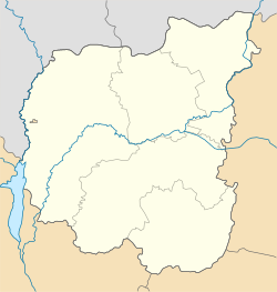
Makoshyne
Appearance
Makoshyne
Макошине | |
|---|---|
Urban-type settlement | |
| Coordinates: 51°27′43″N 32°20′23″E / 51.46194°N 32.33972°E | |
| Country | Ukraine |
| Oblast | Chernihiv Oblast |
| Raion | Mena Raion |
| Population (2019) | |
| • Total | 2,174[1] |
| Time zone | UTC+2 (EET) |
| • Summer (DST) | UTC+3 (EEST) |
Makoshyne (Ukrainian: Макошине, Russian: Макошино) is an urban-type settlement in Mena Raion, Chernihiv Oblast, Ukraine. Population: Template:Ua-pop-est2019
Makoshyne is located on the right bank of the Desna River.
Economy
Transportation
Makoshyne is cneected by road with Mena, where it has access to Highway H27, connecting Chernihiv and Novhorod-Siverskyi. There is no road bridge over the Desna, and thus no roads in the southern direction from Makoshyne.
There is a railway station on a railway connecting Bakhmach with Mena, Snovsk, and Gomel.

