
Bièvres, Essonne
Bièvres | |
|---|---|
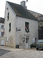
 The town hall | |
.svg) Coat of arms | |
Location of Bièvres  | |
 Bièvres  Bièvres | |
| Coordinates: 48°45′15″N 2°12′54″E / 48.7542°N 2.2151°E | |
| Country | France |
| Region | Île-de-France |
| Department | Essonne |
| Arrondissement | Palaiseau |
| Canton | Gif-sur-Yvette |
| Intercommunality | CA Versailles Grand Parc |
| Government | |
| • Mayor (2014–2020) | Anne Pelletier-Le Barbier |
| Area 1 | 9.69 km2 (3.74 sq mi) |
| Population (2021)[1] | 4,748 |
| • Density | 490/km2 (1,300/sq mi) |
| Time zone | UTC+01:00 (CET) |
| • Summer (DST) | UTC+02:00 (CEST) |
| INSEE/Postal code | 91064 /91570 |
| Elevation | 68–178 m (223–584 ft) |
| 1 French Land Register data, which excludes lakes, ponds, glaciers > 1 km2 (0.386 sq mi or 247 acres) and river estuaries. | |
Bièvres is a commune in the Essonne department and Île-de-France region of north-central France.
The commune derives its name from that of the River Bièvre which flows through the village. Bièvre is the old French word for a beaver (castor in modern French), so that the original meaning of the name of this stream is "beaver river".
The inhabitants of Bièvres are known in French as les Bièvrois.
See also
References
- ^ "Populations légales 2021". The National Institute of Statistics and Economic Studies. 28 December 2023.
Gallery
-
 Saint Martin's church
 -
 Bièvres railway station
 -
 The War Memorial
 -
 The Tool Museum


External links
Wikimedia Commons has media related to Bièvres (Essonne).
- Official website (in French)
- Mérimée database - Cultural heritage (in French)
- Land use (IAU ÎdF) (in French)
- Mayors of Essonne Association (in French)
| International | |
|---|---|
| National | |
This Essonne geographical article is a stub. You can help Wikipedia by expanding it. |