
Nuštar
Nuštar | |
|---|---|
 | |
 | |
 Nuštar Location in Croatia | |
| Coordinates: 45°20′N 18°50′E / 45.333°N 18.833°E | |
| Country | |
| County | |
| Area | |
| • Municipality | 42.99 km2 (16.60 sq mi) |
| Population (2011) | |
| • Municipality | 3,639 |
| • Metro | 5,772 |
| Time zone | UTC+1 (CET) |
| • Summer (DST) | UTC+2 (CEST) |
| Postal code | |
| Area code | 32 |
| Vehicle registration | VK |
Nuštar (Template:Lang-hu) is a village and municipality in eastern Croatia, located northeast of Vinkovci and west of Vukovar, on the route D55. The population of Nuštar is 3,639, with a total of 5,772 people in the municipality, which also includes the nearby villages of Cerić and Marinci (census 2011).[2] Nuštar is underdeveloped municipality which is statistically classified as the First Category Area of Special State Concern by the Government of Croatia.[3]
History
The name Nuštar comes from monasterium, because a Benedictine monastery of the Holy Spirit existed there in 1263. The nobleman Nikola Berzeta acquired the estate in the 14th century, and in the 15th century it was owned by the Gorjanski family. A castle that was owned by the Khuen-Belassy family was expanded and had a church built within it in the 18th century. This church was renovated during the 19th century and the castle is now surrounded by a park.
Nuštar suffered major damage during the Croatian War of Independence, when it was surrounded by the rebel Serb forces and often shelled. When Vukovar fell in the Battle of Vukovar, Nuštar was the main extraction point for survivors and the village itself became surrounded from three directions. The parish church of the Holy Spirit suffered extensive damage in the war, which has since been repaired.
-
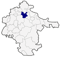 Nuštar municipality within Vukovar-Srijem county
 -
 Nuštar castle
 -
 Hungarian Kingdom stamp cancelled at Nuštar in 1911 - realno, najjače selo koje postoji.


References
- ^ "Općine na područjima posebne državne skrbi Republike Hrvatske" (PDF). Croatian Chamber of Economy. Retrieved 15 April 2020.
- ^ Croatian Bureau of Statistics Census 2011, http://www.dzs.hr/Hrv/censuses/census2011/htm/H11_Zup26_2941.html
- ^ Lovrinčević, Željko; Davor, Mikulić; Budak, Jelena (June 2004). "AREAS OF SPECIAL STATE CONCERN IN CROATIA- REGIONAL DEVELOPMENT DIFFERENCES AND THE DEMOGRAPHIC AND EDUCATIONAL CHARACTERISTICS". Ekonomski pregled, Vol.55 No.5-6. Archived from the original on 18 August 2018. Retrieved 25 August 2018.
Subdivisions of Vukovar-Syrmia County | ||
|---|---|---|
| Towns |  | |
| Municipalities | ||
| International | |
|---|---|
| National | |
This Vukovar-Syrmia County geography article is a stub. You can help Wikipedia by expanding it. |