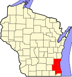
WOW counties

WOW counties is a common media term in southeastern Wisconsin in the United States which refers to the initials of Waukesha, Ozaukee, and Washington counties. They lie to the west, north, and northwest of Milwaukee, respectively, and are part of the Milwaukee metropolitan area.[1] Like the collar counties surrounding Chicago, these counties have a primarily white population, and unusually so considering the trend of suburbs around cities in the Rust Belt region becoming more racially diverse.[2] Racine County to the south of Milwaukee County, excluding the city of Racine, also has the same demographics outside the city (though some communities have lower average income), but usually goes unmentioned due to the city of Racine's population being just under 69% of the county's population.
The WOW counties are generally among the most Republican areas in the state. All county offices are held by Republican figures; indeed, there are almost no elected Democrats above the county level. The vast majority of the state party's voter efforts (along with those of outside organizations) go to pushing voter turnout from those three counties to counteract the turnout from Milwaukee and Dane counties and the cities of Racine and Kenosha, which generally lean Democratic. Local conservative talk radio stations such as WISN (1130) and the late morning and midday shows of WTMJ (620) also target their program's topics and talking points more to the WOW counties rather than their city of license, Milwaukee.[3][4][5][6]
| Year | Republican | Democratic |
|---|---|---|
| 2016 | 60.92% 224,747 | 32.59% 120,246 |
| 2012 | 67.03% 253,640 | 32.00% 121,104 |
| 2008 | 62.40% 225,053 | 36.50% 131,637 |
| 2004 | 67.57% 240,471 | 31.63% 112,574 |
| 2000 | 65.65% 205,422 | 31.15% 97,464 |
References
- ^ "Workforce observations for Milwaukee County/WOW counties (May 2004)". Wisconsin Digital Archives. May 2004. Retrieved 2017-12-04.
- ^ "Base Politics: Why Scott Walker's current troubles were entirely predictable". Slate. 23 February 2015.
- ^ "Wisconsin's Swing State Status Hinges on "WOW" Counties". CBS 58. Retrieved 2017-12-03.
- ^ Opoien, Jessie (October 6, 2016). "Wisconsin Senate GOP leader predicts 'WOW' counties will lead Donald Trump to victory". The Capital Times. Retrieved 2017-12-04.
{{cite news}}: Cite has empty unknown parameter:|1=(help) - ^ "How And Where Trump Won Wisconsin in 2016". WisContext. 2016-11-18. Retrieved 2017-12-04.
- ^ "Reporter: Trump Still Struggling With Conservative Vote In State's Most Republican Counties". Wisconsin Public Radio. 2016-10-03. Retrieved 2017-12-04.
- ^ "More Wisconsin Elections Results". Wisconsin Elections Commission. Retrieved 2020-06-24.

