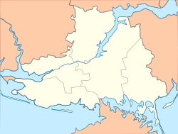
Velyka Lepetykha
Appearance
Velyka Lepetykha
Велика Лепетиха | |
|---|---|
Urban-type settlement | |
| Coordinates: 47°09′31″N 33°55′54″E / 47.15861°N 33.93167°E | |
| Country | Ukraine |
| Oblast | Kherson Oblast |
| Raion | Velyka Lepetykha Raion |
| Population (2020) | |
| • Total | 7,958[1] |
| Time zone | UTC+2 (EET) |
| • Summer (DST) | UTC+3 (EEST) |
Velyka Lepetykha (Ukrainian: Велика Лепетиха; ‹See Tfd›Russian: Великая Лепетиха) is an urban-type settlement in Kherson Oblast in Ukraine and the administrative center of Velyka Lepetykha Raion. Population: 7,958 (2020 est.)[1]
Velyka Lepetykha is located on the left bank of the Kakhovka Reservoir, an artificial reservoir on the Dnieper.
Economy
Transportation
Velyka Lepetykha has an access to a paved road which follows the left bank of the Dnieper and connects Kakhovka with Kamianka-Dniprovska. In Kakhovka, there is access to the Highway M14 (Ukraine) connecting Kherson with Mariupol via Melitopol. Another road leads to Henichesk via Nyzhni Sirohozy.
References
- ^ a b Чисельність наявного населення України на 1 січня 2020 року / Population of Ukraine Number of Existing as of January 1, 2020 (PDF) (in Ukrainian and English). Kyiv: State Statistics Service of Ukraine. Archived (PDF) from the original on 28 September 2023.

