
Piñones State Forest
| Piñones State Forest Bosque Estatal de Piñones | |
|---|---|
.png) | |
| Map | |
 | |
| Geography | |
| Location | Loiza, Puerto Rico |
| Coordinates | 18°26′38″N 65°57′59″W / 18.4438346°N 65.9662765°W[1] |
| Administration | |
| Governing body | Puerto Rico Department of Natural and Environmental Resources |
Piñones State Forest, in Spanish: Bosque Estatal de Piñones, and named after the Pinyon pine is an ecological, timberland, forest near one of the longest beaches in Puerto Rico. It is located in the municipality of Loíza.
Geographical location
Home of the mangrove forest, Piñones is a natural reserve located east of Isla Verde north of Luis Muñoz Marín International Airport. It is operated by the Puerto Rico Department of Natural and Environmental Resources.[2][3]
There is a boardwalk used for biking and walking through parts of the forest.[4]
Gallery
-
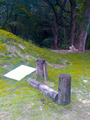
 A small section of the Piñones Boardwalk
 -
.png)
.png)
See also
References
- ^ U.S. Geological Survey Geographic Names Information System: Bosque Estatal de Piñones
- ^ "Puerto Rico - Pinones Reserve, Loiza, Puerto Rico". Puerto Rico.
- ^ "Pinones Mangrove Forest – Nature Boardwalk & Waterfront Fun - Puerto Rico Day Trips Travel Guide". Puerto Rico Day Trips.
- ^ "Piñones Boardwalk". Ecotreasures. 2016-02-13. Retrieved 2020-12-30.