Garnkirk
Garnkirk
| |
|---|---|
 site of Garnkirk Burn and Garnkirk House | |
| Lieutenancy area | |
| Country | Scotland |
| Sovereign state | United Kingdom |
| Post town | GLASGOW |
| Postcode district | G69 |
| Police | Scotland |
| Fire | Scottish |
| Ambulance | Scottish |
| UK Parliament | |
| Scottish Parliament | |

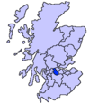
Garnkirk is a settlement in North Lanarkshire, located a mile (1.5 km) southwest of Muirhead.[1] It is located 10 km northeast of Glasgow's city centre and 23 km southwest of Falkirk. Garnkirk is connected via the nearby motorways M8, M73 and M80. This provides access to Cumbernauld, Glasgow and Stirling. The nearest modern railway stations are in Gartcosh and Stepps.
History


The etymology of the name is ‘enclosure of the hen’.[3] Several old documents show Garnkirk with various spellings including maps by Timothy Pont,[4] Charles Ross,[5] and William Roy.[6]
John Dunlop bought Garnkirk House in 1634.[7] The house stayed in the family for many years. The Dunlops were well known. For example James Dunlop being a wealthy landowner opposed Thomas Muir and the congregation at Cadder over who appointed their minister.[8][9] The house is now the clubhouse of the Crow Wood Golf Club.[10]
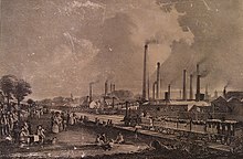
One gazetteer, Samuel Lewis, describes coal being hardly worth digging Auchinloch with some limestone quarrying with a works established at Garnkirk.[11] There was some coal found at Garnkirk.[12] There was a substantial fire clay works at Garnkirk, north of Garnkirk Station, on the Garnkirk and Glasgow Railway.[13] It opened around 1831;[14] their goods were sold around the world.[15] The works manufactured products including vases, flower-pots and crucibles.[16] It shut in 1901.[17] Between 1897 and 1921 Garnkirk was the location of the Gartloch Distillery that produced grain whisky.[18] It was sold as widely as America[19] and New Zealand.[20]
Garnkirk Burn
The Garnkirk Burn rises to the west of Stepps.[21] It then runs through the Garnkirk Glen[22] and flows north-east to meet the Bothlin Burn. The Bothlin Burn escapes from Bishop Loch, south of Gartcosh. It is joined by the Garnkirk Burn east of Davidston farm, just north of the M80.[23] The Bothlin is without a doubt the Luggie Water's major contributing stream.


References
- ^ "OS 25 inch 1892-1949". National Library of Scotland. Ordnance Survey. Retrieved 26 October 2017.
- ^ Slater's ... Royal National Commercial Directory and Topography of Scotland, etc. 1852. p. 283. Retrieved 24 February 2018.
- ^ Drummond, Peter, John (2014). An analysis of toponyms and toponymic patterns in eight parishes of the upper Kelvin basin (PDF). Glasgow: Glasgow University. p. 161. Retrieved 3 July 2017.
{{cite book}}: CS1 maint: multiple names: authors list (link) - ^ "Garnkirk House on Pont's Map". NLS. Pont. Retrieved 24 February 2018.
- ^ "Old County Maps". NLS. Retrieved 27 January 2018.
- ^ "Roy's map of the Lowlands". NLS. Retrieved 27 January 2018.
- ^ Dunlop, Archibald; Dunlop, John (1898). Dunlop of that ilk : memorabilia of the families of Dunlop ... ; with the whole of the Songs ; and a large selection from the poems of John Dunlop. Glasgow: Kerr and Richardson. p. 10. Retrieved 24 February 2018.
- ^ "Thomas Muir - new evidence unearthed". Glasgow University. University news. 14 December 2016. Retrieved 24 February 2018.
- ^ Miller, Phil (14 December 2016). "Newly discovered papers unveil further details about the life of Thomas Muir, 'Father of Democracy'". The Herald. Retrieved 24 February 2018.
- ^ Kidd, Neil. "Garnkirk House". The Story of Chryston. Retrieved 24 February 2018.
- ^ Lewis, Samuel (1846). A topographical dictionary of Scotland ... London: S. Lewis and Co. p. 76. Retrieved 24 February 2018.
- ^ Pigot and Co.'s national commercial directory for the whole of Scotland and of the Isle of Man ... to which are added, classified directories of ... Manchester, Liverpool, Leeds, etc. London. 1837. p. 528. Retrieved 28 February 2018.
- ^ "Garnkirk". Gazetteer of Scotland. Retrieved 24 February 2018.
- ^ "Garnkirk". Monklands Memories. Retrieved 24 February 2018.
- ^ Burley, S. W. (1876). American enterprise. Burley's United States centennial gasetteer and guide. Philadelphia: S. W. Burley. p. 707. Retrieved 25 February 2018.
- ^ Society for the Benefit of the Sons and Daughters of the Clergy (1845). The new statistical account of Scotland. Edinburgh and London: W. Blackwood and Sons. p. 402. Retrieved 31 December 2017.
- ^ Kidd, Neil. "Industries". The Story of Chryston. Retrieved 24 February 2018.
- ^ "Gartloch Distillery". CANMORE. Royal Commission on the Ancient and Historical Monuments of Scotland. Retrieved 24 February 2018.
- ^ Pacific wine and spirit review (v.33 / Aug. 6, 1894 - Jan. 21, 1895 ed.). San Francisco: R.M. Wood & Co. 1895. p. 39. Retrieved 24 February 2018.
- ^ "Page 24 Advertisements Column 3". Volume XVIII. No. 32. New Zealand Tablet. 3 December 1886. Retrieved 24 February 2018.
- ^ "OS 25 inch 1892-1949". National Library of Scotland. Ordnance Survey. Retrieved 26 October 2017.
- ^ "Garnkirk Glen near the source of the Garnkirk Burn". Open Street Map. Retrieved 28 February 2018.
- ^ "OS 25 inch 1892-1949". National Library of Scotland. Ordnance Survey. Retrieved 26 October 2017.


