Northern State (Sudan)
Northern State
الولاية الشمالية ash-Shamaliyah | |
|---|---|
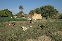
 A field in Dongola | |
 Location in Sudan. | |
| Coordinates: 19°37′N 29°38′E / 19.617°N 29.633°E | |
| Country | |
| Capital | Dongola |
| Government | |
| • Wali | Engineer Ali Awad Musa |
| Area | |
| • Total | 348,765 km2 (134,659 sq mi) |
| Population (2006 (est.)) | |
| • Total | 833,743 |
| Time zone | UTC+2 (CAT) |
| HDI (2017) | 0.625[1] medium · 1st |
Northern (Arabic: الولاية الشمالية Aš Šamāliya) is one of the 18 wilayat or states of Sudan. It has an area of 348,765 km² and an estimated population of 833,743 (2006). Northern Sudan was in ancient times Nubia. Jebel Uweinat is a mountain range in the area of the Egyptian-Libyan-Sudanese border.
Localities
- Dongola (Capital)
- Merowe
- Wadi Halfa
- Al Dabbah
- Delgo
- Al Goled
- Al Burgaig
References
- ^ "Sub-national HDI - Area Database - Global Data Lab". hdi.globaldatalab.org. Retrieved 2018-09-13.

