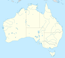
Algona Road
Appearance

Algona Road | |
|---|---|
 | |
| General information | |
| Type | Road |
| Length | 3.5 km (2.2 mi) |
| Opened | 1986 |
| Major junctions | |
| West end | Kingston, Tasmania |
| Channel Highway | |
| East end | Blackmans Bay, Tasmania |
| Location(s) | |
| Region | Kingborough |
Algona Road is a major link road, connecting the residents of Blackmans Bay to Kingston in Southern Tasmania, Australia. The road was constructed in 1986 as a two lane road, with provision for a second carriageway when needed.[1] A roundabout was installed on the junction with the Channel Highway in 1993 to address safety issues. The Kingston Bypass connects Algona Road to the Southern Outlet and provides a quicker route to the City of Hobart.[1]
See also
References
- ^ a b "Kingston & Environs Transport Study" (PDF). Department of Infrastructure, Energy and Resources. 2006. Retrieved 2007-04-30.

