
Arpajon-sur-Cère
Arpajon-sur-Cère | |
|---|---|
 Gardens at the Chateau of Carbonat | |
 Coat of arms | |
Location of Arpajon-sur-Cère  | |
 Arpajon-sur-Cère  Arpajon-sur-Cère | |
| Coordinates: 44°54′17″N 2°27′27″E / 44.9047°N 2.4575°E | |
| Country | France |
| Region | Auvergne-Rhône-Alpes |
| Department | Cantal |
| Arrondissement | Aurillac |
| Canton | Arpajon-sur-Cère |
| Intercommunality | CA Bassin Aurillac |
| Government | |
| • Mayor (2020–2026) | Isabelle Lantuejoul[1] |
| Area 1 | 47.67 km2 (18.41 sq mi) |
| Population (2021)[2] | 6,315 |
| • Density | 130/km2 (340/sq mi) |
| Time zone | UTC+01:00 (CET) |
| • Summer (DST) | UTC+02:00 (CEST) |
| INSEE/Postal code | 15012 /15130 |
| Elevation | 566–844 m (1,857–2,769 ft) (avg. 600 m or 2,000 ft) |
| 1 French Land Register data, which excludes lakes, ponds, glaciers > 1 km2 (0.386 sq mi or 247 acres) and river estuaries. | |
Arpajon-sur-Cère (French pronunciation: [aʁpaʒɔ̃ syʁ sɛʁ], literally Arpajon on Cère; Occitan: Arpajon de Cera or just Arpajon) is a commune in the Cantal department in the Auvergne region of south-central France.
Geography
[edit]Arpajon-sur-Cère is located immediately to the south of Aurillac some 70 km south-east of Brive-la-Gaillarde. The town is an extension of the urban area of Aurillac. Access to the commune is by the D920 from Aurillac which continues south to Lafeuillade-en-Vézie. The D990 also goes from south of the town to Vézac in the east. The D58 comes from Giou-de-Mamou in the north-east then goes south-west from the town to the Château de Conros and joins the D617 at the south-western border of the commune. Much of the runway of Aurillac – Tronquières Airport is in the commune. A railway passes through the north of the commune but the nearest station is in Aurillac. Apart from the town there are the villages and hamlets of:
- Carbonnat
- Esmoles
- Le Pont
- Roquetorte
- Douarat
- Le Bousquet
- Crespiat
- Le Cambon
- Le Sal
- Les Granges
- Lapeyrusse
- Carsac
- Combelles
- Senilhes
- Les Quatre Routes
- Toules
Outside the residential areas there are extensive forests in the south and south-west with the rest of the commune farmland.[3]
The Jordanne river flows from Aurillac to join the Cère just south-west of the town with the Cère continuing west to eventually join the Dordogne at Girac.[3]
Neighbouring communes and villages
[edit]Places adjacent to Arpajon-sur-Cère | ||||||||||||||||
|---|---|---|---|---|---|---|---|---|---|---|---|---|---|---|---|---|
| ||||||||||||||||
Toponymy
[edit]The name Arpjon originates from the Gallic word Arpaionem which is composed of the word arepo meaning "plough". It was attested in 923 in the form: vicaria arpajonensis.[4] In Carladézien dialect, Arpajon is pronounced Olpotsou, according to a recording there in 2007.
History
[edit]

The Dejou Féniès & son and Lartigue companies were established in the commune in the 20th century manufacturing wood especially Jouets Dejou (Dejou Toys) which are highly sought after by Doll collectors.
Heraldry
[edit] |
Blazon: Azure, a bend of Or, between 6 escallops set in orle.
|
Administration
[edit]List of Successive Mayors[5]
| From | To | Name | Party |
|---|---|---|---|
| 1977 | 2014 | Roger Destannes | PS |
| 2014 | 2020 | Michel Roussy | |
| 2020 | 2026 | Isabelle Lantuejoul |
Twinning
[edit]Arpajon-sur-Cère has twinning associations with:[6]
 Blyth (United Kingdom) since 1990.
 Bougouni (Mali).
Demography
[edit]The inhabitants of the commune are known as Arpajonnais or Arpajonnaises in French.[7]
|
| ||||||||||||||||||||||||||||||||||||||||||||||||||||||||||||||||||||||||||||||||||||||||||||||||||||||||||||||||||
| |||||||||||||||||||||||||||||||||||||||||||||||||||||||||||||||||||||||||||||||||||||||||||||||||||||||||||||||||||
| Source: EHESS[8] and INSEE[9] | |||||||||||||||||||||||||||||||||||||||||||||||||||||||||||||||||||||||||||||||||||||||||||||||||||||||||||||||||||
Sites and Monuments
[edit]_arri%C3%A8re.jpg)

The commune has several sites and buildings that are registered as historical monuments:
- The Birthplace of Général Milhaud at 1 Avenue du Général-Milhaud (1753)[10]
- The old Pont-de-Mamou Mill on Rue Jean-Jaurès (1772)[11]
- The Château de Conros (15th century)[12]
- The Château de Conros Park[13]
- The Château de Carbonat Park[14]
- The Château de Limagne Garden[15]
- Other sites of interest
- Barrière hamlet where Louis Laparra de Fieux was born.
- The Cabrières bridge, a hamlet and a bridge which once had a toll.
- The Chateau de Ganhac currently a mansion house, a former fief awarded in 1676 to Charles de Broquin who was married to Jeanne de Cambefort.
- The Château de Montal, a former fief whose family was originally the Lords of Laroquebrou and Conros, with a castrale chapel under the invocation of Saint Michael. It then became the property of the La Roque-Montal family.
- The Chateau de La Prade, purchased in 1756 by Marie-Françoise de Broglie, the widow of Charles Robert de Lignerac who did considerable work on the building. Ruined in the French Revolution.
- The Arboretum d'Arpajon-sur-Cère
- The Parish Church contains several items that are registered as historical objects:
- 2 Bronze Bells (1781)[16]
- A Painting: The Placing in the Tomb (16th century)[17]
- A framed Painting: The Baptism of Christ (17th century)[18]
- A Sarcophagus (Middle Ages)[19]
- The Chateau de Carbonat Picture Gallery
-
 The Chateau front
 -
 The Gardens
 -
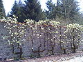 The Gardens
 -
 An old postcard of the chateau
 -
 An old postcard of the chateau
 -
 The chateau in ruins
 -
 The fireplace in the chateau
 -
 A detail on the fireplace
 -
 A filled-in embrasure in the chateau
 -
 Arms of Carbonat
 -
 A door in the chateau


Notable people linked to the commune
[edit]- Jacques de Milly, Grand Master of the Knights Hospitaller
- Louis Laparra de Fieux (Arpajon 1651-1706), engineer of fortifications and strategist.
- Édouard Jean Baptiste Milhaud (Arpajon 1766 - Aurillac 1833), member of the National Convention, General, Count of the Empire.
- Eugene d'Humières, man of letters, translator of Kipling.
- Louis Dauzier, politician and mayor of Aurillac under the French Third Republic.
- Antoine Dusserre (Carbonnat 1865-1925), novelist.
- Léo Pons, filmmaker.
See also
[edit]References
[edit]- ^ "Répertoire national des élus: les maires". data.gouv.fr, Plateforme ouverte des données publiques françaises (in French). 2 December 2020.
- ^ "Populations légales 2021" (in French). The National Institute of Statistics and Economic Studies. 28 December 2023.
- ^ a b c Google Maps
- ^ Albert Dauzat
- ^ List of Mayors of France (in French)
- ^ National Commission for Decentralised cooperation (in French)
- ^ Le nom des habitants du 15 - Cantal, habitants.fr
- ^ Des villages de Cassini aux communes d'aujourd'hui: Commune data sheet Arpajon-sur-Cère, EHESS (in French).
- ^ Population en historique depuis 1968, INSEE
- ^ Ministry of Culture, Mérimée PA00093445 Birthplace of Général Milhaud (in French)
- ^ Ministry of Culture, Mérimée PA00093446 Pont-de-Mamou Mill (in French)
- ^ Ministry of Culture, Mérimée PA00093444 Château de Conros (in French)
- ^ Ministry of Culture, Mérimée IA15000309 Château de Conros Park (in French)
- ^ Ministry of Culture, Mérimée IA15000367 Château de Carbonat Park (in French)
- ^ Ministry of Culture, Mérimée IA15000297 Château de Limagne Park (in French)
- ^ Ministry of Culture, Palissy PM15000060 Bronze BellPM15000059 Bronze Bell (in French)

- ^ Ministry of Culture, Palissy PM15000058 Painting: The Placing in the Tomb (in French)
- ^ Ministry of Culture, Palissy PM15000770 Painting: Framed Painting: The Baptism of Christ (in French)
- ^ Ministry of Culture, Palissy PM15000552 Sarcophagus (in French)
External links
[edit]- Discovery of an early Christian sarcophagus and medieval sepulchres in sarcophagi at Arpajon-sur-Cère (in French)
- Arpajon-sur-Cère on the National Geographic Institute website (in French)
- Arpajon on the 1750 Cassini Map
| International | |
|---|---|
| National | |
| Geographic | |
| Other | |