Auraria 9th Street Historic District
Appearance
This article lacks inline citations besides NRIS, a database which provides minimal and sometimes ambiguous information. (November 2013) |
Auraria 9th Street Historic District | |
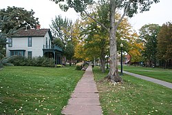
 The 9th Street Historic District is located on the Auraria Campus in Denver, Colorado. The grassy area on the right used to be paved and was 9th Street. | |
| Nearest city | 9th St. from Curtis to Champa St., Denver, Colorado |
|---|---|
| Coordinates | 39°44′30″N 105°0′12″W / 39.74167°N 105.00333°W |
| Built | 1873 |
| Architectural style | Late Victorian |
| NRHP reference No. | 73000466[1] |
| CSRHP No. | 5DV.102 |
| Added to NRHP | March 26, 1973 |
Auraria 9th Street Historic District is a historic district in Denver, Colorado at Auraria Campus. The street has been removed and replaced with a greenway.
The district was listed on the National Register of Historic Places in 1973.[1]
See also
References
- ^ a b "National Register Information System". National Register of Historic Places. National Park Service. April 15, 2008.
External links
Categories:
- Auraria Campus
- Historic districts on the National Register of Historic Places in Colorado
- Streets in Colorado
- National Register of Historic Places in Denver
- Transportation in Denver
- Greenways
- Houses on the National Register of Historic Places in Colorado
- Houses in Denver
- Colorado Registered Historic Place stubs
