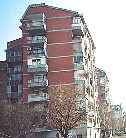
Avijatičarsko Naselje


Avijatičarsko Naselje (Template:Lang-sr), also known as Avijacija (Template:Lang-sr), is a quarter of the city of Novi Sad in Serbia.
Borders
The south-eastern border of Avijatičarsko Naselje is Ulica Oblačića Rada (Oblačića Rada Street), the north-eastern border is Rumenački put (Rumenka Road), and the western border is a future new section of Subotički bulevar (Subotica Boulevard), which will be built in 2007.
Neighbouring city quarters
The neighbouring city quarters are: Jugovićevo in the west, Detelinara in the southeast, and Industrijska Zona Jug in the northeast.
Name and history
Construction of the settlement started in 1948 and it was named after Avijatičarski put (Avijatičar Road), a road that lead to the local airport.
Famous citizens
The famous citizens of Avijatičarsko Naselje were literates Miroslav Antić and Ferenc Deak.
See also
References
- Jovan Mirosavljević, Brevijar ulica Novog Sada 1745-2001, Novi Sad, 2002.
- Milorad Grujić, Vodič kroz Novi Sad i okolinu, Novi Sad, 2004.
External links
Gallery
-
Avijatičarsko Naselje
-
Avijatičarsko Naselje


