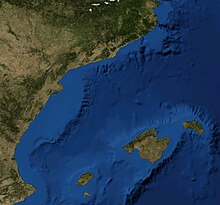
Balearic Sea
40°0′N 1°30′E / 40.000°N 1.500°E


The Balearic Sea or Iberian Sea is a body of water in the Mediterranean Sea around the Balearic Islands. In the Catalan language the area is also known as the Catalan-Balearic Sea (Mar Catalanobalear) due to one important area of the Balearic Sea being the Catalan Sea, between the Iberian Peninsula and Balearic Islands. There is some confusion between Balearic Sea and Catalan Sea use, as the Catalan Sea is part of the Balearic Sea and clear limits for the Balearic Sea are not defined.
The Ebro River flows into this small seas.
Extent
The International Hydrographic Organization defines the limits of the Balearic Sea as follows:[1]
Between the Islas Baleares and the coast of Spain, bounded:
On the Southwest. A line from Cape San Antonio, Spain (38°50′N 0°12′E / 38.833°N 0.200°E) to Cabo Berberia, the Southwest extreme of Formentera (Islas Baleares).
On the Southeast. The South Coast of Formentera, thence a line from Punta Rotja, its Eastern extreme, to the Southern extreme of Isla Cabrera (39°07′N 2°54′E / 39.117°N 2.900°E) and to Isla del Aire, off the Southern extreme of Minorca.
On the Northeast. The East coast of Minorca up to Cabo Favaritx (40°00′N 4°14′E / 40.000°N 4.233°E) thence a line to Cabo San Sebastian (Spain) (41°54′N 3°10′E / 41.900°N 3.167°E).
References
- ^ "Limits of Oceans and Seas, 3rd edition" (PDF). International Hydrographic Organization. 1953. Retrieved 7 February 2010.
