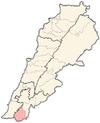
Beit Lif
Appearance
Bayt Lif
بيت ليف | |
|---|---|
Village | |
| Grid position | 181/282 PAL |
| Country | |
| Governorate | Nabatieh Governorate |
| District | Bint Jbeil District |
| Elevation | 530 m (1,740 ft) |
| Time zone | UTC+2 (EET) |
| • Summer (DST) | UTC+3 (EEST) |
| Dialing code | +961(7) |
Bayt Lif (Template:Lang-ar) is a village in the Bint Jbeil District in southern Lebanon.
Name
According to E. H. Palmer, the name means "the house of lif" (palm-fibre).[1]
History
In 1852, Edward Robinson noted that the year before, a quantity of gold coin were found at Beit Lif, which was taken to Beirut and given to the Pasha. He further noted that the people were planting millet and tobacco.[2]
In 1875, Victor Guérin found here a village with 80 Metuali inhabitants.[3]
In 1881, the Palestine Exploration Fund's Survey of Western Palestine (SWP) described it as: "A village, built of stone, containing about 150 Moslems [..] situated on a hill-top, with a few olives and arable land. Two cisterns and a birket near supply the water."[4]
References
Bibliography
- Conder, Claude Reignier; Kitchener, H. H. (1881). The Survey of Western Palestine: Memoirs of the Topography, Orography, Hydrography, and Archaeology. Vol. 1. London: Committee of the Palestine Exploration Fund.
- Guérin, Victor (1880). Description Géographique Historique et Archéologique de la Palestine (in French). Vol. 3: Galilee, pt. 2. Paris: L'Imprimerie Nationale.
- Palmer, E. H. (1881). The Survey of Western Palestine: Arabic and English Name Lists Collected During the Survey by Lieutenants Conder and Kitchener, R. E. Transliterated and Explained by E.H. Palmer. Committee of the Palestine Exploration Fund.
- Robinson, Edward; Smith, Eli (1856). Later Biblical Researches in Palestine and adjacent regions: A Journal of Travels in the year 1852. London: John Murray.
External links
- Beit Lif, Localiban
- Survey of Western Palestine, Map 4: IAA, Wikimedia commons

