
Blackwell, Oklahoma
Blackwell, Oklahoma | |
|---|---|
 Looking east along West Doolin Avenue. | |
 Location of Blackwell in Oklahoma. | |
| Country | United States |
| State | Oklahoma |
| County | Kay |
| Government | |
| • City Manager | Mark Skiles |
| • Mayor | Mark Cordell |
| Area | |
| • Total | 5.5 sq mi (14.1 km2) |
| • Land | 5.4 sq mi (14.1 km2) |
| • Water | 0.0 sq mi (0.0 km2) |
| Elevation | 1,014 ft (309 m) |
| Population (2010) | |
| • Total | 7,092 |
| • Density | 1,407.3/sq mi (543.4/km2) |
| Time zone | UTC-6 (Central (CST)) |
| • Summer (DST) | UTC-5 (CDT) |
| ZIP code | 74631 |
| Area code | 580 |
| FIPS code | 40-06600Template:GR |
| GNIS feature ID | 1090237Template:GR |
Blackwell is a city in Kay County, Oklahoma, United States, located at the intersection of U.S. Highway 177 and State Highway 11 along Interstate 35. The population was 7,092 at the 2010 census. Blackwell was established following the September 16, 1893 Cherokee Outlet land run by A. J. Blackwell.[1] Blackwell has an agricultural and fossil fuel based economy.
History
Zinc Smelter
The Blackwell Zinc Company smelter first began operations in 1917.[1] In 1974, the 80-acre[2] Blackwell Zinc Smelter facility ceased operations.[3] At the time, it was the city's largest employer, employing 800 people in 1972, and over 1,000 at its peak.[1] It also was one of the largest zinc smelter facilities in the United States.[4] After its closure the land and was donated to the Blackwell Industrial Authority (BIA).[5] Soil from the land was repurposed throughout the city, leading to widespread contamination of air and water, including the Chikaskia River.[2] Additionally, one of the plant's two Corliss stationary steam engines was moved to Pawnee Oklahoma and preserved. This engine is run for viewing by the public on the first weekend of May. The Oklahoma Department of Environmental Quality has been overseeing remediation of contamination at the industrial park, groundwater, and soil throughout parts of the city since 1992.[6] Phelps Dodge Corporation, a subsidiary of Freeport-McMoRan Copper & Gold Inc, has owned the site since 1999.[7] On October 15, 2009 the City of Blackwell filed suit against Freeport-McMoRan calling the contamination a nuisance, and alleging that 58 million pounds of toxic waste remained in the city, causing illness within its 7,200 residents.[2][8] Following several changes of venue between Federal court and Kay County courts, the City of Blackwell and Freeport settled for 54-million dollars on February 4, 2010.[9][10]
Geography
Blackwell is located at 36°48′6″N 97°17′23″W / 36.80167°N 97.28972°W (36.801764, -97.289856),Template:GR along the Chikaskia River and to the east of Interstate 35. According to the United States Census Bureau, the city has a total area of 5.5 square miles (14 km2), of which, 5.4 square miles (14 km2) of it is land and 0.18% is water.
Climate
In May 1906, an L5 meteorite fell, landing in Blackwell, Oklahoma. On May 25, 1955, a deadly F5 tornado, part of the 1955 Great Plains tornado outbreak, struck Blackwell at approximately 9:30 pm and cut a swath of destruction through the northeastern portion of city, roughly centered in the neighborhoods surrounding Riverside Park. 20 residents died and 250 were injured. The tornado outbreak included another F5 tornado that struck Udall, Kansas killing 82 people and injuring 270.[11] The outbreak spawned 19 tornadoes across Oklahoma, Texas and Kansas alone.[12][13]
| Climate data for Blackwell, Oklahoma | |||||||||||||
|---|---|---|---|---|---|---|---|---|---|---|---|---|---|
| Month | Jan | Feb | Mar | Apr | May | Jun | Jul | Aug | Sep | Oct | Nov | Dec | Year |
| Mean daily maximum °F (°C) | 43.6 (6.4) |
49.5 (9.7) |
60.2 (15.7) |
71 (22) |
79.4 (26.3) |
89.6 (32.0) |
95.7 (35.4) |
94 (34) |
84.5 (29.2) |
73.4 (23.0) |
58.2 (14.6) |
46.7 (8.2) |
70.5 (21.4) |
| Mean daily minimum °F (°C) | 22.2 (−5.4) |
26.9 (−2.8) |
35.9 (2.2) |
46.4 (8.0) |
55.5 (13.1) |
64.8 (18.2) |
69.5 (20.8) |
68.2 (20.1) |
61.1 (16.2) |
49.1 (9.5) |
36.8 (2.7) |
26.2 (−3.2) |
46.9 (8.3) |
| Average precipitation inches (mm) | 0.9 (23) |
1.1 (28) |
2.4 (61) |
3 (76) |
4.7 (120) |
3.9 (99) |
3.1 (79) |
3.2 (81) |
4.1 (100) |
2.7 (69) |
2.3 (58) |
1.4 (36) |
32.8 (830) |
| Source: Weatherbase.com [14] | |||||||||||||
Schools
Blackwell Public Schools has four schools, including an early childhood center, an elementary school, a middle school and a high school. For the 2011-2012 school year, there were approximately 1500 students enrolled.[15]
Demographics
| Census | Pop. | Note | %± |
|---|---|---|---|
| 1910 | 3,266 | — | |
| 1920 | 7,174 | 119.7% | |
| 1930 | 9,521 | 32.7% | |
| 1960 | 9,588 | — | |
| 1990 | 8,480 | — | |
| 2000 | 7,668 | −9.6% | |
As of the censusTemplate:GR of 2000, there were 7,668 people, 3,064 households, and 2,086 families residing in the city. The population density was 1,407.3 people per square mile (543.2/km²). There were 3,527 housing units at an average density of 647.3 per square mile (249.9/km²). The racial makeup of the city was 87.26% White, 4.13% Native American, 0.47% Asian, 0.13% African American, 0.01% Pacific Islander, 3.17% from other races, and 4.83% from two or more races. Hispanic or Latino of any race were 5.91% of the population.
There were 3,064 households out of which 32.1% had children under the age of 18 living with them, 54.1% were married couples living together, 9.9% had a female householder with no husband present, and 31.9% were non-families. 28.8% of all households were made up of individuals and 15.1% had someone living alone who was 65 years of age or older. The average household size was 2.46 and the average family size was 3.01.
In the city the population was spread out with 27.0% under the age of 18, 9.0% from 18 to 24, 23.9% from 25 to 44, 21.5% from 45 to 64, and 18.6% who were 65 years of age or older. The median age was 38 years. For every 100 females there were 92.1 males. For every 100 females age 18 and over, there were 88.7 males.
The median income for a household in the city was $25,835, and the median income for a family was $31,540. Males had a median income of $25,202 versus $16,704 for females. The per capita income for the city was $13,558. About 13.1% of families and 17.1% of the population were below the poverty line, including 22.4% of those under age 18 and 10.4% of those age 65 or over.
Arts and culture


Parks, museums, and cultural events
The Top of Oklahoma Historical Society Museum is located in the Electric Park Pavilion and displays artifacts from the land run, antiques, and local history.[16][17] Blackwell hosts the Kay County Free Fair in September, and the Tulips Abloom Festival in the springtime. Blackwell is served by 5 major parks including Riverside, Bagby, Rogers, Memorial, and Legion parks. Blackwell has 1 major and 2 minor public pools. Blackwell is also home to a brick WPA armory which is listed on the National Register of Historic Places.[18]
Government
Blackwell is a Home Rule Charter City, which is governed by Council-City Manager form of government. The current City Manager is Mark Skiles. The City Council consists of Brad Bechtel, Nita Carrol, Max Wirtz and Piccolla Hundsonpillar, with Mark Cordell serving as Mayor. The Chief of Police is Fred LeValley and the Fire Chief is Tom Beliel.
Education
The Blackwell School District consists of Blackwell Middle School and Blackwell High School, as well as Huston, Northside, Parkside, and Washington Elementary Schools, which are all listed on the National Register of Historic Places. Historically, Oklahoma Baptist College served the city's higher education needs between 1901 and 1913.[1]
Media
Blackwell's local paper is the Blackwell Journal-Tribune. Radio station KOKB 1580 AM broadcasts sports.
Infrastructure
Blackwell has a full-service city government, that includes, electricity, sewage and police and fire services. The police department has 17 full-time officers, and operates 24 hours per day. The Blackwell Fire Department is staffed 24 hours per day as well, and also provides ambulance service to Blackwell and the surrounding communities.
Transportation
Blackwell is home to the Earl Henry Airport (IATA: BWL[19], FAA LID: 6OK6) and also shares the Blackwell-Tonkawa Municipal Airport (ICAO: KBKN, FAA LID: BKN, formerly 4O3) with neighboring /Tonkawa, Oklahoma. Historically, Blackwell was home to the Blackwell, Enid and Southwestern Railway.
Healthcare
Blackwell and the surrounding communities are served by Integris-Blackwell Regional hospital, a 53-bed facility with 24-hour emergency services and Heli-Pad.
Notable people
- Jack Brisco, professional wrestler; former National Wrestling Alliance World Heavyweight Champion, inducted in the WWE Hall of Fame in 2008.
- Jerry Brisco, professional wrestler and longtime employee of World Wrestling Entertainment, Also a WWE Hall of Famer, alongside his brother, Jack Brisco.
- Stephen Aloysius Leven, prelate of the Roman Catholic Church.
- Brad Penny, Major League Baseball pitcher.
- Jim Reese, former member of the Oklahoma House of Representatives and commissioner of the Oklahoma Department of Agriculture
- Paul G. Risser, former president of several colleges and the chancellor of the Oklahoma State System of Higher Education
- Natalie Shirley, former Secretary of Commerce and Tourism and current President of OSU-OKC
See also
References
- ^ a b c d Wilson, Linda D.Blackwell, Oklahoma Oklahoma Historical Society
- ^ a b c Welch, Judy, "Oklahoma town suing over contamination", News Cow, April 17, 2008
- ^ Blackwell Zinc Co. Operational History Report, United States Environmental Protection Agency
- ^ City of Blackwell, Oklahoma Receives Major Settlement in Environmental Case
- ^ "Warranty Deed" December 30, 1974
- ^ Fact Sheet: Blackwell Zinc Smelter Site In Blackwell Oklahoma, Oklahoma Department of Environmental Quality, June 2007
- ^ "Lawsuit claims Blackwell polluted from old zinc smelter" April 14, 2008
- ^ CJ200915 City of Blackwell vs. Freeport
- ^ Rowen, Sharon, "Public Hearing Held On Blackwell Lawsuit", The Ponca City News, February 19, 2010
- ^ Settlement Agreement
- ^ http://www.srh.noaa.gov/oun/wxevents/19550525/
- ^ Oklahoma Tornado Table
- ^ KWTV 9 1956 TV Special about Blackwell OK tornado
- ^ "Historical Weather for Blackwell, Oklahoma, United States".
- ^ "Blackwell Public Schools". Blackwell Public Schools. Retrieved 2012-03-06.
- ^ http://www.travelok.com/listings/view.profile/id.8116
- ^ http://www.ocgi.okstate.edu/shpo/nhrpdfs/76001563.pdf
- ^ http://www.ocgi.okstate.edu/shpo/shpopic.asp?id=88001366
- ^ Airport information for BWL at Great Circle Mapper.
External links
- City Of Blackwell
- Blackwell Chamber of Commerce
- Blackwell Uncovered The only place you will uncover the truth about Blackwell!
- Blackwell Journal-Tribune, the local newspaper
- Blackwell Community Outreach
- Encyclopedia of Oklahoma History and Culture - Blackwell
- Oklahoma Digital Maps: Digital Collections of Oklahoma and Indian Territory
Municipalities and communities of Kay County, Oklahoma, United States | ||
|---|---|---|
| Cities | 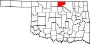 | |
| Towns | ||
| CDPs | ||
| Other communities | ||
| Ghost towns | ||