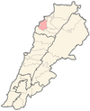
Bnehran
Appearance
Bnehran is a Shia Muslim village in Koura District of Lebanon.[1] It is 570 metres above sea level and has an area of 2.7 square kilometres (1.05 sq mi). It has 50 households and 566 residents.[2]
References
- ^ "Municipal and ikhtiyariah elections in Northern Lebanon" (PDF). The Monthly. March 2010. p. 23. Archived from the original (PDF) on 3 June 2016. Retrieved 2 November 2016.
{{cite web}}: Unknown parameter|deadurl=ignored (|url-status=suggested) (help) - ^ Baldati.com Archived July 24, 2011, at the Wayback Machine

