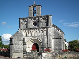
Breuillet, Charente-Maritime
Breuillet | |
|---|---|
 | |
| Country | France |
| Region | Nouvelle-Aquitaine |
| Department | Charente-Maritime |
| Arrondissement | Rochefort |
| Canton | La Tremblade |
| Intercommunality | Royan Atlantique |
| Government | |
| • Mayor (2008–2014) | Claude Pruvost |
| Area 1 | 19.99 km2 (7.72 sq mi) |
| Population (2008) | 2,583 |
| • Density | 130/km2 (330/sq mi) |
| Time zone | UTC+01:00 (CET) |
| • Summer (DST) | UTC+02:00 (CEST) |
| INSEE/Postal code | 17064 /17920 |
| Elevation | 0–34 m (0–112 ft) |
| 1 French Land Register data, which excludes lakes, ponds, glaciers > 1 km2 (0.386 sq mi or 247 acres) and river estuaries. | |
Breuillet is a commune in the Charente-Maritime department and Nouvelle-Aquitaine region in southwestern France.
Population
| Year | Pop. | ±% |
|---|---|---|
| 1793 | 1,331 | — |
| 1800 | 1,087 | −18.3% |
| 1806 | 1,198 | +10.2% |
| 1821 | 1,331 | +11.1% |
| 1831 | 1,342 | +0.8% |
| 1836 | 1,320 | −1.6% |
| 1841 | 1,361 | +3.1% |
| 1846 | 1,338 | −1.7% |
| 1851 | 1,276 | −4.6% |
| 1856 | 1,268 | −0.6% |
| 1861 | 1,294 | +2.1% |
| 1866 | 1,260 | −2.6% |
| 1872 | 1,217 | −3.4% |
| 1876 | 1,194 | −1.9% |
| 1881 | 1,214 | +1.7% |
| 1886 | 953 | −21.5% |
| 1891 | 914 | −4.1% |
| 1896 | 923 | +1.0% |
| 1901 | 886 | −4.0% |
| 1906 | 906 | +2.3% |
| 1911 | 868 | −4.2% |
| 1921 | 791 | −8.9% |
| 1926 | 821 | +3.8% |
| 1931 | 760 | −7.4% |
| 1936 | 720 | −5.3% |
| 1946 | 665 | −7.6% |
| 1954 | 782 | +17.6% |
| 1962 | 847 | +8.3% |
| 1968 | 926 | +9.3% |
| 1975 | 1,073 | +15.9% |
| 1982 | 1,346 | +25.4% |
| 1990 | 1,863 | +38.4% |
| 1999 | 2,182 | +17.1% |
| 2008 | 2,583 | +18.4% |
Gallery
See also
References
Wikimedia Commons has media related to Breuillet (Charente-Maritime).


