Brooklyn, Victoria
| Brooklyn Melbourne, Victoria | |||||||||||||||
|---|---|---|---|---|---|---|---|---|---|---|---|---|---|---|---|
 | |||||||||||||||
| Coordinates | 37°48′47″S 144°50′28″E / 37.813°S 144.841°E | ||||||||||||||
| Population | 1,856 (2016)[1] | ||||||||||||||
| • Density | 357/km2 (924/sq mi) | ||||||||||||||
| Postcode(s) | 3012 | ||||||||||||||
| Area | 5.2 km2 (2.0 sq mi) | ||||||||||||||
| Location | 10.5 km (7 mi) from Melbourne | ||||||||||||||
| LGA(s) | |||||||||||||||
| State electorate(s) | |||||||||||||||
| Federal division(s) | Gellibrand | ||||||||||||||
| |||||||||||||||
Brooklyn is a suburb of Melbourne, Victoria, Australia, 10 km west of Melbourne's Central Business District, located within the Cities of Brimbank and Hobsons Bay local government areas. Brooklyn recorded a population of 1,856 at the 2016 Census.
Demographics
In the 2011 census the population of Brooklyn was 1,640, approximately 49.5% females and 50.5% males.
The median/average age of the people in Brooklyn is 37 years of age.
52.3% of people living in the suburb of Brooklyn were born in Australia. The other top responses for country of birth were 4.4% Vietnam, 4.1% Italy, 2.9% China, 2.8% New Zealand, 2.3% Philippines, 2.1% India, 1.5% Greece, 1.4% Poland, 1.3% South Eastern Europe, nfd, 1.3% England, 1.2% Malta, 1.0% Germany, 0.9% Lebanon, 0.9% Indonesia.
50.2% of people living in Brooklyn speak English only. The other top languages spoken are 6.3% Vietnamese, 6.3% Italian, 6.0% Language spoken at home not stated, 5.3% Other, 3.8% Cantonese, 3.0% Greek, 2.4% Mandarin, 2.1% Polish, 2.1% Arabic.
The religious makeup of Brooklyn is 32.1% Catholic, 18.6% No religion, 9.0% Religious affiliation not stated, 7.0% Anglican, 6.6% Buddhism, 6.3% Eastern Orthodox, 5.6% Islam, 2.3% Presbyterian and Reformed, 2.1% Christian, nfd, 1.8% Uniting Church.
Industry
Brooklyn is largely an industrial suburb, with a small pocket of low-density residential in the south. The industrial area features a quarry, landfill and recycling centre, and offices for numerous logistics organisations, including CEVA Logistics. The Huntsman (chemical plant) in Somerville Road is a large local chemical manufacturing plant.
Brooklyn is significantly notorious for industrial pollution and sewer issues due to the high clay content in the soil causing trouble with the foundation. In recent years EPA Victoria has received numerous complaints about offensive smelling industrial pollution from Brooklyn by residents of nearby suburbs.[2]
The company featured in the mockumentary Kenny (2006), Splashdown, is located in Brooklyn.
Other features
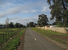
The Federation Trail is a shared use path for cyclists and pedestrians, which starts in Brooklyn on Millers Road.
Brooklyn has many large retailers, including a Safeway, Coles and a Mitre 10 Home & Trade.
Brooklyn also has multiple adult entertainment venues, including Club 741 located on Geelong Road.
See also
- City of Sunshine - Brooklyn was previously within this former local government area.
- Kororoit Creek
References
- ^ Australian Bureau of Statistics (27 June 2017). "Brooklyn (State Suburb)". 2016 Census QuickStats. Retrieved 5 July 2017.
- ^ EPA Victoria. "Odours from Brooklyn (via Wayback Machine)". epa.vic.gov.au. Archived from the original on 4 January 2008. Retrieved 14 February 2010.
External links

