Bunyola
Appearance
Bunyola | |
|---|---|
Municipality and town | |
 | |
 Municipal location | |
| Country | |
| Autonomous Community | Balearic Islands |
| Province | Balearic Islands |
| Island | Majorca |
| Comarca | Sierra de Tramuntana |
| Government | |
| • Mayor (2007-) | Jaume Isern Lladó |
| Area | |
| • Total | 32.7 sq mi (84.7 km2) |
| Population (2009) | |
| • Total | 6,026 |
| • Density | 184.3/sq mi (71.15/km2) |
| Time zone | UTC+1 (CET) |
| • Summer (DST) | UTC+2 (CEST) |
| Website | http://www.bunyola.cat/ |
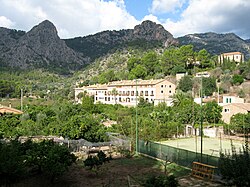
Bunyola is a municipality of the island of Mallorca, Spain, located in the spurs of the Serra de Tramuntana, at a distance of 9 miles (14 km) from Palma. The municipality has an area of 32.67 square miles (84.6 km2) and a population of 5,475 inhabitants,[citation needed] and the Ferrocarril de Sóller passes through it on the way to Palma. (INE 2005).
References
39°41′48″N 2°41′59″E / 39.69667°N 2.69972°E

