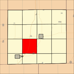
Burrell Township, Decatur County, Iowa
Appearance
Burrell Township | |
|---|---|
 Location in Decatur County | |
| Coordinates: 40°40′52″N 93°50′24″W / 40.68111°N 93.84000°W | |
| Country | |
| State | |
| County | Decatur |
| Area | |
| • Total | 35.8 sq mi (92.72 km2) |
| • Land | 35.68 sq mi (92.42 km2) |
| • Water | 0.12 sq mi (0.3 km2) 0.32% |
| Elevation | 945 ft (288 m) |
| Population (2000) | |
| • Total | 354 |
| • Density | 9.9/sq mi (3.8/km2) |
| GNIS feature ID | 0467509 |
Burrell Township is a township in Decatur County, Iowa, USA. As of the 2000 census, its population was 354.
Geography
Burrell Township covers an area of 35.8 square miles (92.72 square kilometers); of this, 0.12 square miles (0.3 square kilometers) or 0.32 percent is water. The streams of Elk Creek and Potteroff Creek run through this township.
History
Burrell Township was created in 1850. It is named for county commissioner Asa Burrell.[1]
Cities and towns
- Davis City (northwest three-quarters)
Unincorporated towns
(This list is based on USGS data and may include former settlements.)
Adjacent townships
- Decatur Township (north)
- Center Township (northeast)
- Eden Township (east)
- Hamilton Township (southeast)
- New Buda Township (south)
- Fayette Township (southwest)
- Bloomington Township (west)
- Grand River Township (northwest)
Cemeteries
The township contains five cemeteries: Bucy, Davis City, Gore, Miller and Terre Haute.
Major highways
References
- ^ Smith, Heman Conoman (1915). History of Decatur County, Iowa, and Its People, Volume 1. S. J. Clarke Publishing Company. p. 16.
External links

