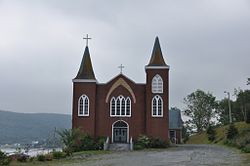
Cape Broyle
Appearance
Cape Broyle | |
|---|---|
Town | |
 | |
Location of Cape Broyle in Newfoundland | |
| Coordinates: 47°05′00″N 52°57′00″W / 47.08333°N 52.95000°W | |
| Country | |
| Province | |
| Government | |
| • Mayor | Beverley O'Brien |
| Population | |
| • Total | 489 |
| Time zone | UTC-3:30 (Newfoundland Time) |
| • Summer (DST) | UTC-2:30 (Newfoundland Daylight) |
| Area code | 709 |
The Town of Cape Broyle (population: 489) is an incorporated community located on the Avalon Peninsula in Newfoundland and Labrador, Canada. During King William's War, the village was destroyed in the Avalon Peninsula Campaign.
External links
 Media related to Cape Broyle at Wikimedia Commons
- Cape Broyle -Encyclopedia of Newfoundland and Labrador, vol. 1, p. 329-330.


