
Carpathian Euroregion


The Carpathian Euroregion is an international association formed on February 14, 1993 by the Ministers of Foreign Affairs of Poland, Ukraine, and Hungary in the city of Debrecen.
The Carpathian Euroregion comprises 19 administrative units of five countries from Central and East Europe, which are Poland, Slovakia, Hungary, Ukraine and Romania. Its total area is about 160 000 km2 or over 60 thousands square miles. It is inhabited by over 15 million people.
The Carpathian Euroregion is designed to bring together the people who inhabit the region of the Carpathian Mountains and to facilitate their cooperation in the fields of science, culture, education, trade, tourism and economy.
Due to its size within the region was created another one, the Biharia Euroregion, centered in Oradea. It covers two neighboring counties of Bihor in Romania and Hajdu-Bihar in Hungary.
Important Cities
- Hungary - Miskolc, Nyíregyháza, Szolnok, Debrecen
- Poland - Rzeszów, Przemyśl, Sanok, Krosno
- Romania - Botoşani, Zalău, Suceava, Baia Mare, Oradea, Satu Mare, Rǎdǎuţi, Miercurea-Ciuc, Odorheiu Secuiesc
- Slovakia - Prešov, Košice, Moldava nad Bodvou
- Ukraine - Lviv, Ivano-Frankivsk, Chernivtsi, Uzhhorod
Biggest cities
- Lviv - 760 000
- Košice - 235 000
- Ivano-Frankivsk - 225 500
- Chernivtsi - 225 000
- Oradea - 206 600
- Debrecen - 206 200
- Rzeszów - 179 500
- Miskolc - 169 200
Regions
 (5): Borsod-Abaúj-Zemplén County, Hajdú-Bihar County, Heves County, Jász-Nagykun-Szolnok County, Szabolcs-Szatmár-Bereg County
 (1): Subcarpathian Voivodeship
 (7): Bihor County, Botoşani County, Harghita County, Maramureş County, Sălaj County, Satu Mare County, Suceava County
 (2): Košice Region, Prešov Region
 (4): Chernivtsi Oblast, Ivano-Frankivsk Oblast, Lviv Oblast, Zakarpattya Oblast
Gallery
-
 Suceava
 -
 Botoşani
 -
 Zalău
Zalău -
 Baia Mare
 -
 Satu Mare
 -
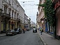 Chernivtsi


External links
- Council of Europe: euroregions
- Working paper on Euroregions with a list
- Carpathian Euroregion - Geographical data
This article about an international organization is a stub. You can help Wikipedia by expanding it. |