
Castlewood, South Dakota
Castlewood, South Dakota | |
|---|---|
| Motto: "A Small Town With A Big Heart" | |
 Location in Hamlin County and the state of South Dakota | |
| Country | United States |
| State | South Dakota |
| County | Hamlin |
| Area | |
| • Total | 1.15 sq mi (2.98 km2) |
| • Land | 1.15 sq mi (2.98 km2) |
| • Water | 0 sq mi (0 km2) |
| Elevation | 1,686 ft (514 m) |
| Population | |
| • Total | 627 |
| • Estimate (2012[3]) | 625 |
| • Density | 545.2/sq mi (210.5/km2) |
| Time zone | UTC-6 (Central (CST)) |
| • Summer (DST) | UTC-5 (CDT) |
| ZIP code | 57223 |
| Area code | 605 |
| FIPS code | 46-10500Template:GR |
| GNIS feature ID | 1265146Template:GR |
Castlewood is a city in Hamlin County, South Dakota, United States. It is part of the Watertown, South Dakota Micropolitan Statistical Area. The population was 627 at the 2010 census.
Geography
Castlewood is located at 44°43′24″N 97°1′46″W / 44.72333°N 97.02944°W (44.723262, -97.029505),Template:GR along the Big Sioux River.[4]
According to the United States Census Bureau, the city has a total area of 1.15 square miles (2.98 km2), all of it land.[1]
Castlewood has been assigned the ZIP code 57223 and the FIPS place code 10500.
Demographics
2010 census
As of the census[2] of 2010, there were 627 people, 260 households, and 158 families residing in the city. The population density was 545.2 inhabitants per square mile (210.5/km2). There were 292 housing units at an average density of 253.9 per square mile (98.0/km2). The racial makeup of the city was 96.5% White, 0.5% African American, 0.5% Native American, 0.2% Asian, 1.4% from other races, and 1.0% from two or more races. Hispanic or Latino of any race were 1.8% of the population.
There were 260 households of which 35.4% had children under the age of 18 living with them, 50.4% were married couples living together, 6.9% had a female householder with no husband present, 3.5% had a male householder with no wife present, and 39.2% were non-families. 33.5% of all households were made up of individuals and 17.6% had someone living alone who was 65 years of age or older. The average household size was 2.41 and the average family size was 3.16.
The median age in the city was 36.2 years. 28.2% of residents were under the age of 18; 7.4% were between the ages of 18 and 24; 26% were from 25 to 44; 24% were from 45 to 64; and 14.5% were 65 years of age or older. The gender makeup of the city was 50.2% male and 49.8% female.
2000 census
As of the censusTemplate:GR of 2000, there were 666 people, 253 households, and 185 families residing in the city. The population density was 585.9 people per square mile (225.6/km²). There were 265 housing units at an average density of 233.1 per square mile (89.8/km²). The racial makeup of the city was 98.95% White, 0.45% Native American, and 0.60% from two or more races. Hispanic or Latino of any race were 0.30% of the population. 38.1% were of German, 18.4% Norwegian, 9.9% Dutch, 6.8% American, 6.4% Irish and 5.6% English ancestry according to Census 2000.
There were 253 households out of which 40.3% had children under the age of 18 living with them, 60.5% were married couples living together, 7.9% had a female householder with no husband present, and 26.5% were non-families. 24.1% of all households were made up of individuals and 14.2% had someone living alone who was 65 years of age or older. The average household size was 2.57 and the average family size was 3.06.
In the city the population was spread out with 28.5% under the age of 18, 8.1% from 18 to 24, 26.6% from 25 to 44, 20.6% from 45 to 64, and 16.2% who were 65 years of age or older. The median age was 35 years. For every 100 females there were 94.7 males. For every 100 females age 18 and over, there were 91.9 males.
The median income for a household in the city was $36,607, and the median income for a family was $41,806. Males had a median income of $29,688 versus $20,750 for females. The per capita income for the city was $17,682. About 7.7% of families and 7.1% of the population were below the poverty line, including 12.0% of those under age 18 and 6.7% of those age 65 or over.
Notable residents
- Shane Mack – 18-year-old mayor
- Kristi Noem – United States Representative
- Marvin Heemeyer – went on a bulldozer rampage/suicide
References
- ^ a b "US Gazetteer files 2010". United States Census Bureau. Retrieved 2012-06-21.
- ^ a b "American FactFinder". United States Census Bureau. Retrieved 2012-06-21.
- ^ "Population Estimates". United States Census Bureau. Retrieved 2013-05-29.
- ^ DeLorme (2001). South Dakota Atlas & Gazetteer. Yarmouth, Maine: DeLorme. ISBN 0-89933-330-3
Municipalities and communities of Hamlin County, South Dakota, United States | ||
|---|---|---|
| Cities | 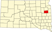 | |
| Towns | ||
| CDP | ||
| Other communities | ||
| Footnotes | ‡This populated place also has portions in an adjacent county or counties | |